In the productive, complex and hard-to-reach wetlands of coastal Gabon, scientists used innovative remote sensing technologies—including unmanned aerial vehicles—to create a highly accurate map of 100,000 square kilometers despite limited budgets, field data, and accessibility to many of the areas.
The Gist
The coast of Gabon contains Africa’s third largest freshwater delta, and possibly one of the most intact across the continent, if not globally. The wetlands here include six Ramsar Wetlands of International Importance, including the Bas Ogooué, and the government of Gabon is currently developing a management plan that meets the criteria of the Ramsar Convention.
The new map, as described in Remote Sensing in Ecology and Conservation, is now being used for internal zoning of Gabon’s coastal wetlands management plan to designate which places need to be protected for biodiversity and ecosystem services, like flood control, and which sites can be designated for socioeconomic activities such as fisheries and logging.
The map is also being used to expand the Ramsar site boundaries to include biologically rich areas of the Ogooué River delta. In addition to Ramsar site management planning and revisions, the map is also being used to evaluate protection options for habitats that are home to endemic fish species, and to better understand the hydrology and ecology of small endorheic wetlands in the eastern portion of the project area.
The Big Picture
If a picture is worth a thousand words, an accurate map may well be worth an entire novel. But getting those accurate maps — especially in places where budgets are limited and landscapes are remote or otherwise inaccessible — can be an incredible challenge.
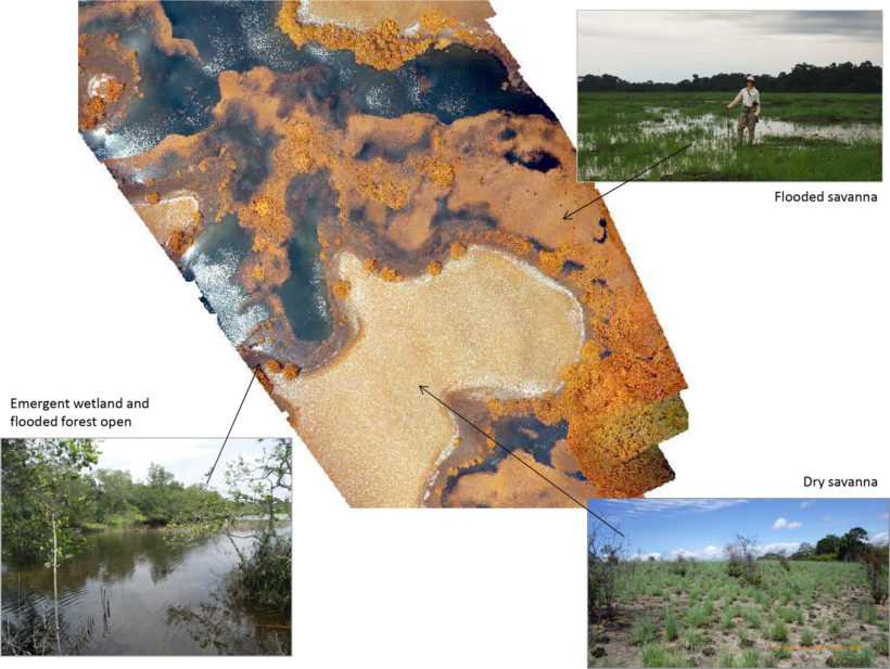
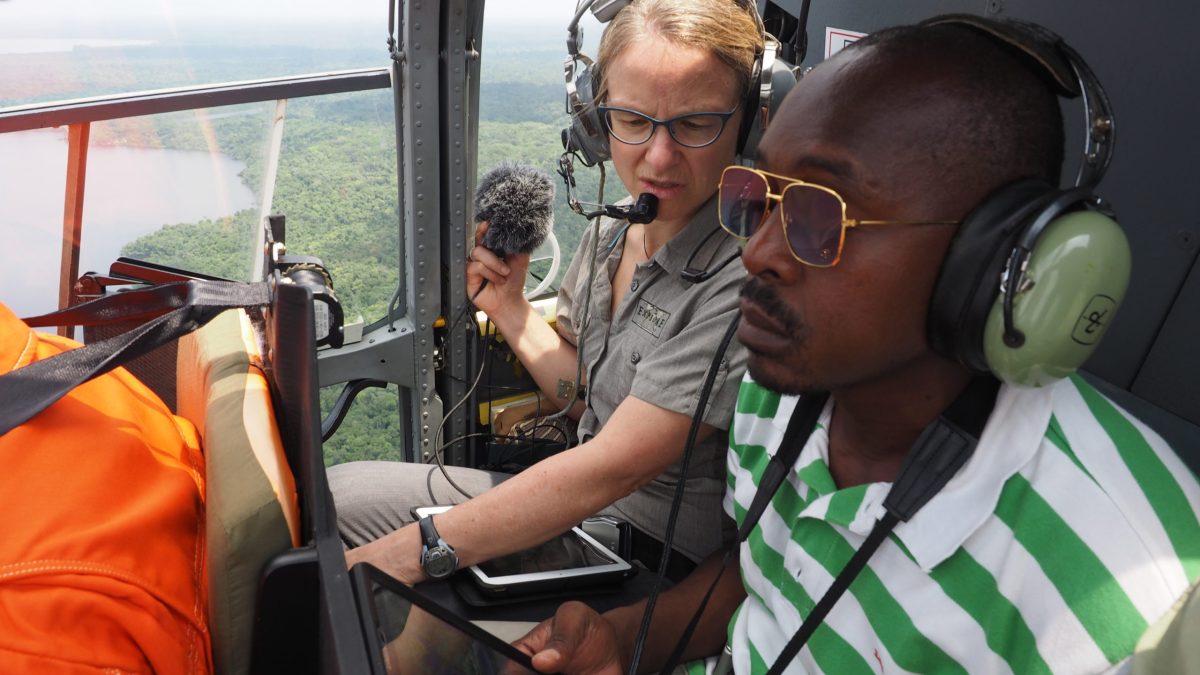
In Gabon, scientists solved this problem by collecting field data from unmanned aerial vehicles (UAV) launched from a boat on the river, and used these data to train and classify image objects created from optical and radar satellite images. The radar imagery was particularly useful for identifying flooded forests and penetrating cloud cover. They identified 15 land cover classes, of which nine were wetland. Upon completion of the map, a post-classification accuracy assessment was conducted using helicopter-based video and photos. A stratified random sample accuracy assessment of the final classification yielded an overall accuracy of 80 percent.
The Takeaway
These kinds of advances in mapping are particularly valuable for remote places – especially in tropical areas — where ground-based surveys are difficult, optical satellite imagery is consistently hampered by persistent cloud cover, and the baseline data that could be used to infer wetland habitat types, such as digital elevation models, hydrographic maps, or soils maps are either not available or of low resolution or accuracy.
“This project showed how new technologies and innovative approaches can be quickly tested and the results put to immediate use for the benefit of protecting extremely important conservation regions,” said Marie-Claire Paiz, TNC’s Gabon country director.
“In Gabon, our maps showed that the original boundaries of their Ramsar sites didn’t include some of the most diverse wetlands of the river delta. The Gabonese government is now working on adjusting the site boundaries to be sure this vital landscape will be protected and properly managed. This is good news for Gabon, but it’s also important to note that the benefits of these remote sensing techniques are also applicable far beyond one country.”
References:
Data Accessibility: The map can be viewed on ArcGIS online at this link: https://arcg.is/0Hb0eP. The data and associated metadata can be downloaded from the University of Southern Mississippi's AQUILA database: https://aquila.usm.edu/datasets/3/


Join the Discussion