At first glance, I thought it was a mule deer. I’ve hiked into this rocky valley of sagebrush and mountain mahogany for 20 years, and I can always count on seeing a lot of mule deer. But this deer had…a long tail?
I pulled up binoculars and saw the animal was lower to the ground and was slinking like a predator. A mountain lion, my first in the wild.
This was just the latest spectacular sighting in one of my favorite places, public land off the Owyhee Uplands Backcountry Byway in southwestern Idaho. It’s nearly 100 miles between towns here. I’ve seen beautiful wildflowers and lonely desert canyons, bobcats and badgers, prairie falcons and golden eagles. I’ve almost stepped on rattlesnakes and have been within a few feet of the rare pygmy rabbit.
The “sagebrush sea” covers 150 million acres of 13 states. Visitors on Western U.S. road trips often overlook it in favor of the granite peaks and pine forests of the Rockies. I’ve heard people describe it as barren, desolate and empty.
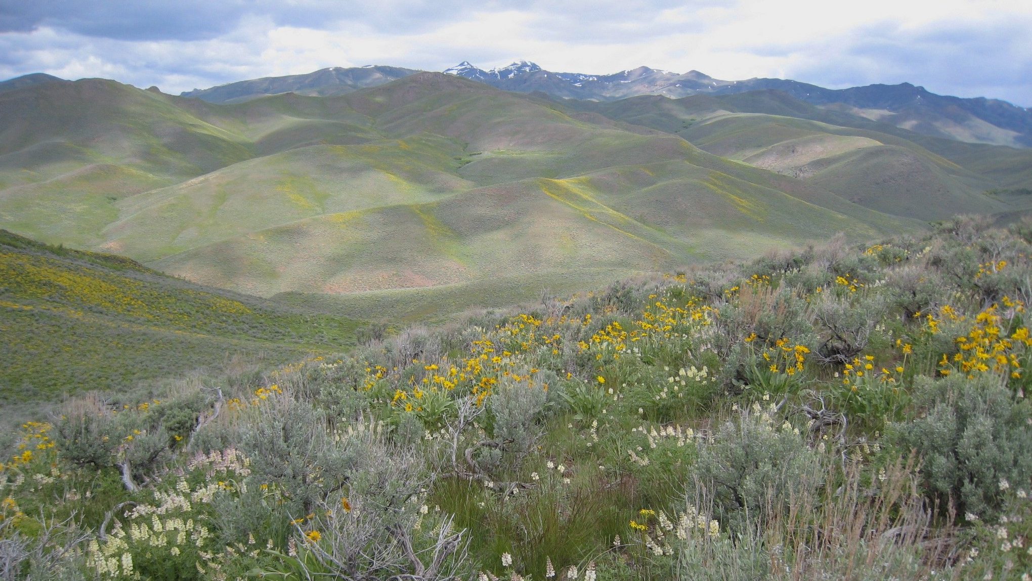
None of which is true. Indigenous people have lived here for thousands of years, living off the abundant wildlife. That history is told in the land if you know where to look.
This is also a biologically rich landscape. As a naturalist, I’ve found the wildlife viewing is often easier and more varied than in the more famous national forests of the Rockies.
A casual look might suggest the sagebrush sea is still large and undeveloped, although this habitat faces a long list of threats and more than 1 million acres is lost annually to invasive weeds, fire and other factors. The Nature Conservancy has worked here for decades; you can go deep into that conservation work via this interactive web site.
And perhaps the best way to understand why this ecosystem is so important is to visit for yourself. Here’s a starting point. I asked TNC conservation staff to list their favorite places and here are their six picks. You’ll find abundant wildlife and stunning scenery…often with a fraction of the crowds you’ll find at the popular national parks.
Top 10 List
-
Steens Mountain, Oregon
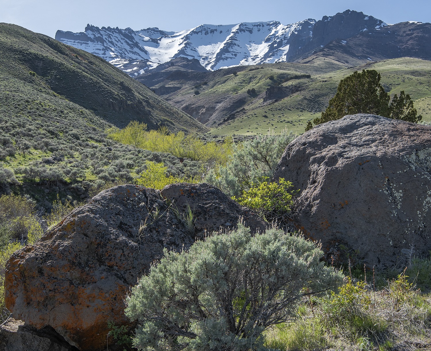
Oregon’s Cottonwood Creek © Mark Darnell In recent years, I’ve taken to exploring eastern Oregon with fly rod in hand. The arid landscape may not look like a place to find trout, but there are small creeks in the canyons and hills, often home to native redband and cutthroat trout. Eastern Oregon, with a low population density and endless vistas, holds many surprises.
It can be many miles between services and there is not much of a tourist infrastructure. Where should a first-time visitor begin to experience the wonders of the “Oregon Outback”? My colleague Garth Fuller, Eastern Oregon conservation director, points to Steens Mountain. It’s a place TNC has worked collaboratively for decades, and also rewards the visitor with wildlife, views and wildflowers.
“The Steens Mountain Loop road showcases the diversity of this landscape and offers great views,” he says. “It’s an introduction to what makes this place special.”
Steens Mountain rises out of the surreal flats of the Alvord Desert. It’s a monolith that stretches a mile high and 50 miles long. It’s a place that rewards a slow pace to enjoy the unique flora. Fuller notes that, with the change in elevation, the native plants shift from sagebrush and juniper to aspen to alpine flowers.
Wildflower blooms can be spectacular. And there are plant species abundant here that can be found nowhere else on earth. (If you have the chance to join a botanical tour here, jump on it).
Steens Mountain Loop covers 57 miles and also offers spectacular views. Fuller and I both love the East Rim Viewpoint, offering a stunning look at the flats of the Alvord Desert. You can, on a clear day, see four states from here.
“It may be the view that best shows how wild, connected and diverse this landscape is,” Fuller says.
Note: Please check road conditions before making this trip. Winter avalanches may delay road openings.
-
Craters to Pioneers, Idaho
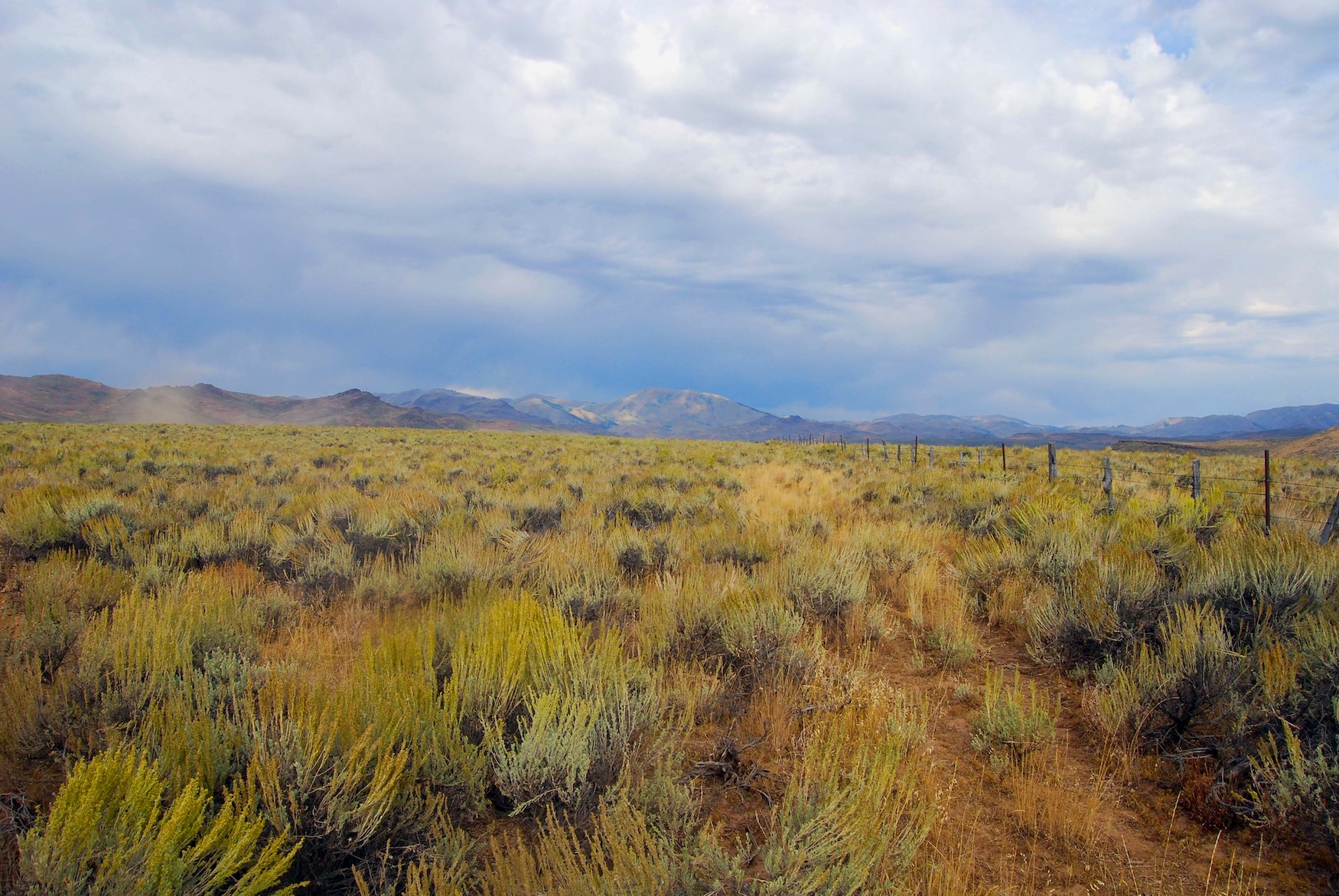
Craters to Pioneers, Idaho © Dayna Gross / TNC This southcentral Idaho landscape is also one of contrasts, with lava fields rising to 12,000-foot peaks. The Nature Conservancy has protected more than 95,000 acres of ranchlands here, working lands that connect extensive public lands.
It’s a great place for outdoor recreation. “The Pioneers may look like brown hills when you’re driving through at 65 miles per hour,” says Tess O’Sullivan, TNC’s land and water protection program manager in Idaho. “But slow down, and all these cool features reveal themselves. There are springs and creeks and groves of aspen. These are also what makes this place so important to wildlife.”
This is a place where you can see a sage grouse strut and also have a chance of encountering a wolverine.
A great place to start your exploration is Craters of the Moon National Monument, shaped by thousands of years of lava flows. You can get up close to cinder cones and walk into a lava cave. This reserve is home to a unique population of lava-dwelling pikas and an endemic chipmunk.
There’s a loop road that offers great interpretation of the geology, and a campground where you can actually pitch a tent next to lava formations. And don’t miss a chance to peer at the night sky. This whole landscape is part of a “dark sky reserve,” offering some of the best stargazing in the United States.
-
Fremont Island, Utah
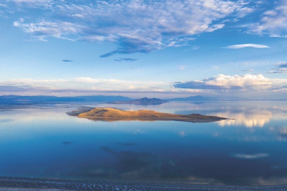
Fremont Island, Utah. © Charles Uibel The best view of the sagebrush sea (as in the previous two destinations) is to stand on top of a mountain and look out over the arid land. Fremont Island offers the unique perspective of looking up at sage-steppe habitats.
Fremont Island is the third-largest island in Utah’s Great Salt Lake. “It’s like you are at the bottom of a bowl on this island,” says Ann Neville, TNC’s Utah Northern Mountains regional director. “From here, you have a 360-degree view of mountains. You can see snow-capped peaks. And it looks like you’re surrounded by these foothills covered in sagebrush. I love that view.”
Once the only major island on the Great Salt Lake not owned by the state, Fremont Island has now been protected by a partnership between TNC and state agencies. The 3,000-acre island is open to hiking and biking, but getting there can be an adventure in itself.
Fremont Island is great if you’re looking for a more intimate experience of the lake. In higher water years, you need an airboat to access the island. In low water years, you can hike or bike across the flats. It’s a 7-mile trip, so bring plenty of water and necessary supplies. “The best hike is along the ridgeline that allows you to cover the whole island,” says Neville
Antelope Island State Park, is more accessible and offers a similar view of the surrounding sagebrush sea. It’s the Great Salt Lake’s biggest island and is a popular location for tourists and local visitors. One good vantage point is Buffalo Point which is a short climb from a parking area with a spectacular view of the lake and the surrounding area.
-
Great Basin National Park, Nevada
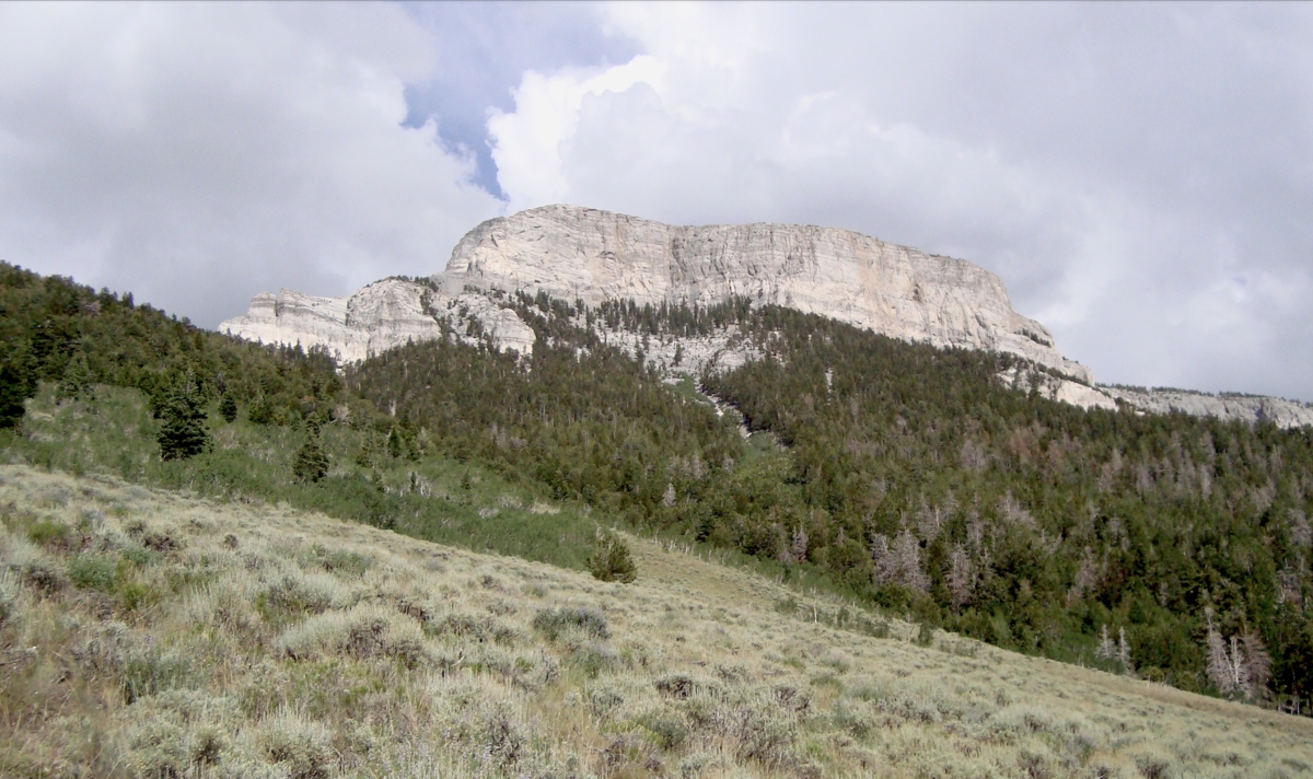
Great Basin National Park © Louis Provencher Great Basin National Park is one of the least visited national parks in the United States. That’s ok with Louis Provencher, TNC’s director of science in Nevada. He’s spent more than 20 years working in and exploring the park and the larger landscape of the Snake Range.
He’s partnered with the National Park Service on a number of conservation projects, giving him an appreciation of the mountain range’s diverse ecology. “This is an area with a high number of rare, endemic species,” he says. “The national park is known for its reptile and small mammal diversity. There are bighorn sheep and Bonneville cutthroat trout. There is the classic Great Basin sagebrush vegetation, but also bristlecone pines.”
The park’s best-known feature is the Lehman Caves, the reason it was originally protected. But Provencher recommends the southern part of the park, almost unvisited in comparison to most national park sites.
“If you want solitude, it’s the place to go. If you want to see natural systems you wouldn’t normally see, it’s worth the effort,” Provencher says. “You’ll need a 4-wheel-drive, good boots and plenty of water.”
Provencher says that sitting by a 4,000-year-old bristlecone pine is an almost spiritual experience. He says that spending time here gets you away from the photo stops and peak bagging and other pursuits that can distract from the natural wonder of the place.
“I like an intimate experience in nature,” he says. “In Great Basin National Park, I can hear running water, see the plant and animal diversity around me. There are places that no people go. Those are my favorite parts.”
-
Big Hole Valley, Montana
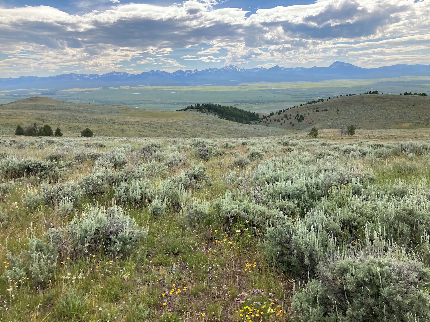
Big Hole Valley, Montana © Jim Berkey From a conservation standpoint, Montana’s Big Hole Valley has it all: a connected and undammed river, wide-ranging wildlife and intact sagebrush habitat. That’s why TNC has worked here since the late 1990s, working with ranchers on water agreements that keep this river flowing.
For Jim Berkey, TNC’s High Divide Headwaters director, this valley showcases the Great Basin’s ranching heritage. He has spent years working with ranchers here on conservation agreements and appreciates their tenacity in the face of some of the harshest weather in Montana.
“They’re still putting up hay the old way, by tractor and horse,” he says. “These are people who have a history of toughing it out.”
This is not a valley most tourists will visit. There’s the Big Hole National Battlefield, a tragic site where Nez Perce were ambushed by federal troops.
Most other visitors come for the world-class fly fishing. While the river continues to face challenges, it remains a popular destination and local communities offer fly shops, guides and eating and dining options. For me, the most interesting aspect of the fishing is also the reason why TNC and other conservationists began working here: the Arctic grayling.
The grayling, with its sail-like fin, is a beautiful fish more often associated with Alaska and Canada. The Big Hole is the only remaining native grayling population in the “lower 48” that spends its whole life cycle in the river. The chance of encountering one of these fish is a draw for many.
“It’s a chance to experience the only major free-flowing tributary to the Missouri,” says Berkey.
-
The Golden Triangle, Wyoming
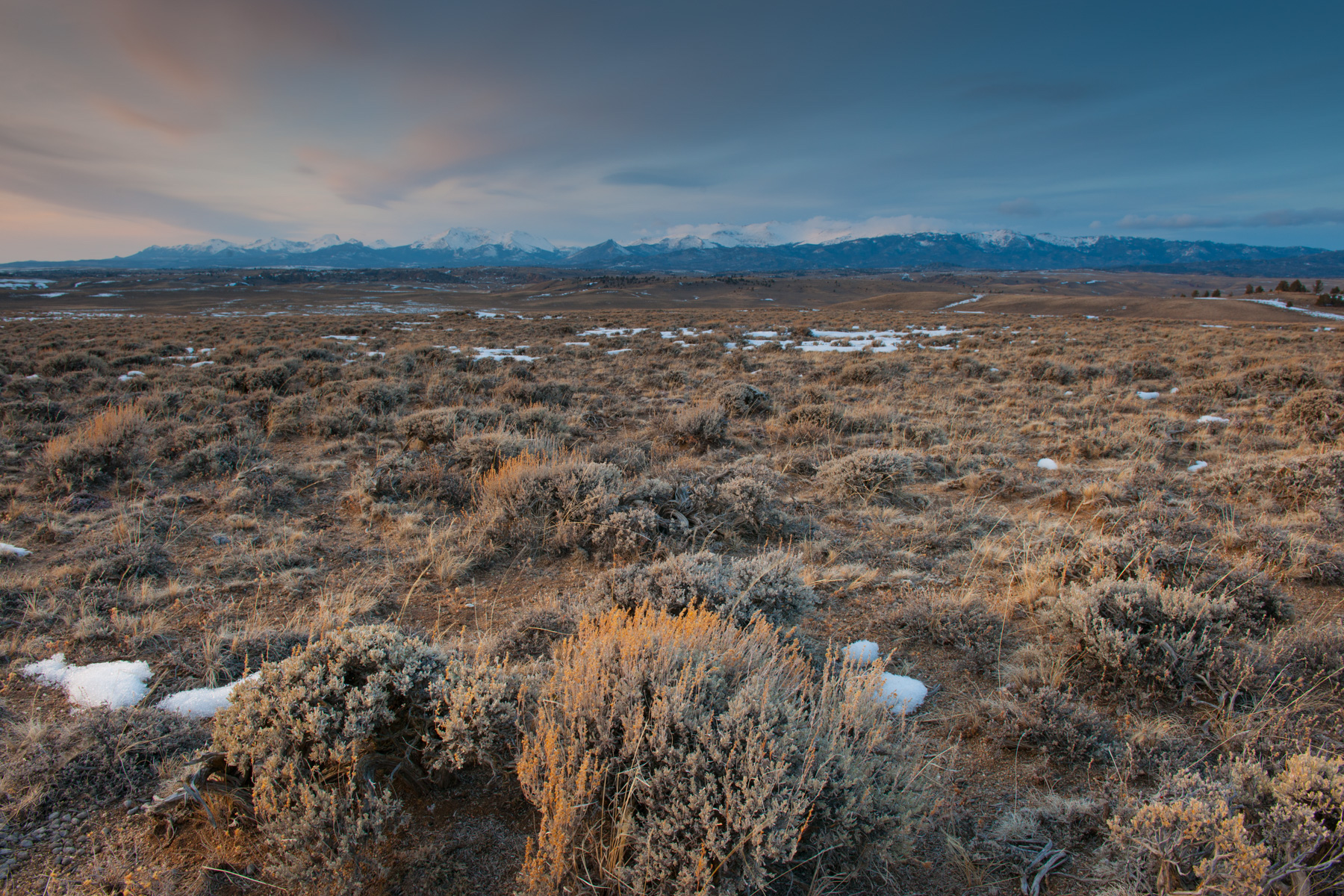
Golden Triangle, Wyoming. © Jen Lamb Unlike other places on this list, Wyoming’s “Golden Triangle” isn’t an officially designated location. It’s the informal name given to a landscape that stretches across more than 360,000 acres of western Wyoming between Rock Springs and western flank of the Wind River Mountains.
While you won’t find a national park boundary, if you want to experience the classic unbroken “sagebrush sea,” this is the place. There are working ranches here and you can access it via dirt roads. But no paved roads cut through the triangle.
“It’s about as remote as you can get in the lower 48,” says Jennifer Lamb, TNC’s director of conservation programs in Wyoming. “It also is the best of the best for sage grouse habitat, supporting some of the highest-density populations and largest leks, or breeding grounds, anywhere in the United States.”
Many wilderness lovers will pass through or near the Golden Triangle en route to the spectacular Wind River Mountains. But if you are seeking solitude and adventure, Lamb says this is a great place to explore on foot, mountain bike or vehicle.
While remote, it’s not inaccessible. Lamb suggests starting at the small town of Farson and taking the Lander Cutoff Road. It’s a dirt road, but fairly well maintained. Just avoid it in winter and when it is wet.
“It’s a place where the quality of the sagebrush has remained high. It’s extraordinary,” says Lamb. “It’s also the kind of place where you feel there’s nothing around for miles and miles.”


So good to see TNC involved in innovative methods for “landscape scale” restoration to suppress invasive pant communities.
Does the Carrizo Plains National qualify? Since TNC is involved with BLM per their website in dealing with this region in CA.
You forgot eastern WA. Not well known, but stunning land!
My type of places. Amazingly I have never been to the Golden Triangle in Wyoming.
Thank you! These are my kind of places and protecting them is why I donate to TNC! Hoping to be able to visit these places someday. 🙂