A version of this story appeared in the Winter 2019 issue of Nature Conservancy Magazine.
Rene Woods slams on the brakes as five emus dash across the road, zig zagging like drunken ballerinas in front of our Land Cruiser.
We’re five hours north of Melbourne and eight hours west of Sydney — in the middle of nowhere. Or as they say here in Australia, we’re out woop woop. And though I’ve lived here for more than a year, I’m still not used to dodging 6-foot-tall birds on my morning commute.
I’ve traveled to the heart of Australia’s bread basket, the Murray-Darling Basin, to explore some of the last wild wetlands in the region. Stretching across an area more than twice the size of California, the basin boasts an agricultural industry which produces more than $15 billion USD worth of rice, fruit, milk and other agricultural goods every year. But like the American Midwest, the land here is highly altered.
Rene, a TNC project manager and my guide for the day, barely blinks as the birds dash past, their tail feathers fluttering like a tutu.
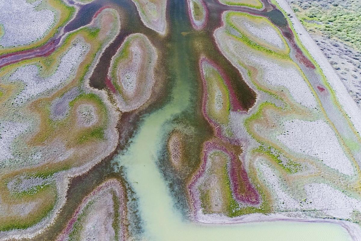
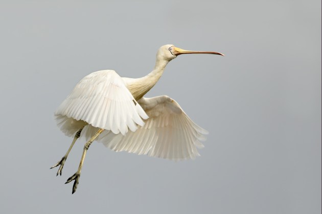
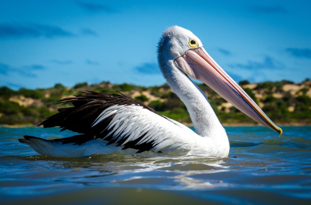
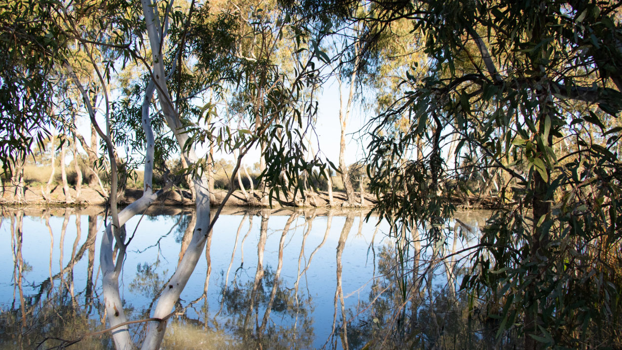
We’re driving toward a vast reed swamp that TNC recently purchased for $38 million USD — the Great Cumbung. This swamp and the adjoining lands contain some of the last large wetlands in drought-prone New South Wales, making it a critical lifeline for water birds, like straw-necked ibis, yellow-billed spoonbill, and Australian pelicans.
Today’s agenda is to visit the nearly 350-square-mile property next door to the swamp, called Gayini by the Nari Nari people, an indigenous community of which Rene is a member. His long line of ancestors have lived on Gayini for at least 50,000 years. In other words, Rene’s people were already here when Neanderthals still inhabited Europe.
In the first half of the 20th century, however, the Australian government gave the land to soldiers returning from two world wars. The new owners turned forests and floodplains into irrigated farms and dusty sheep paddocks.
Today, most of the water from the Murray, Darling, and other major rivers in the aptly named Riverina region is allocated for use by agricultural landowners, cities, and towns. Rene says that the process leaves precious little available for wetlands, but he promises to show me a place where nature is still flourishing.
Emu collision averted, we continue driving on along the top of a wide dirt embankment bordered by a deep, dry channel on either size. The surrounding land is so monotonous and flat that that if the ragged grass were swapped with corn I’d swear I was in Kansas.
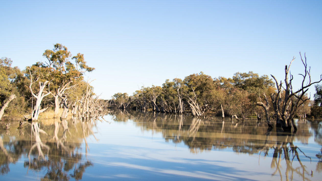
Just as I start to wonder how this place can possibly be a conservation project, Rene pulls up behind another truck. We’ve reached the end of the road, where suddenly a vast wetland comes into view, spilling out across the horizon in front of us. I gasp, doing a double-take between the lifeless field in the rearview mirror and the lush wetland ahead.
We step out into the windy winter sunshine. From my vantage point on top of the embankment I can see water flowing from the wetlands through a pipe beneath our feet, flowing out into the dry shrubs on the other side of the road.
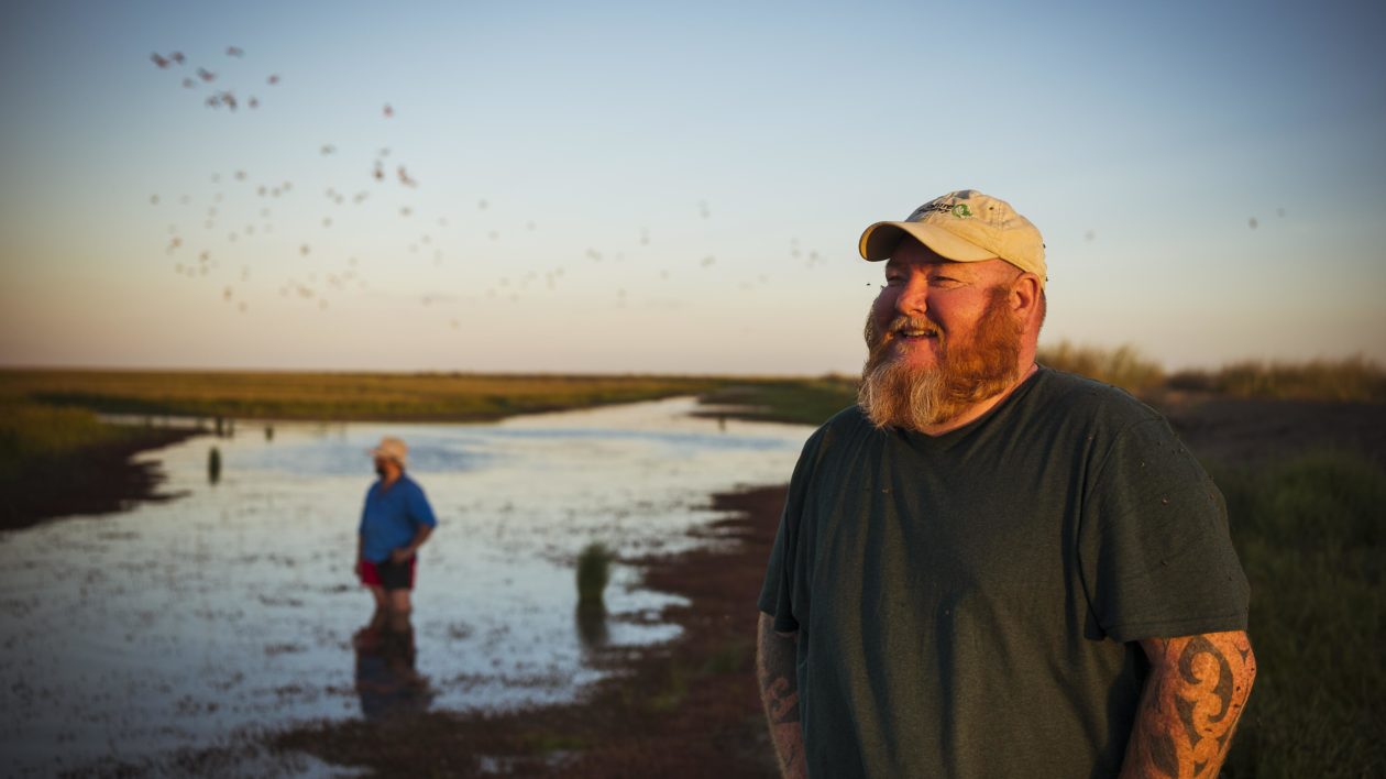
“This is where we’ll probably have a bird breeding event,” says Jamie Woods, Rene’s brother and property manager at Gayini, as he waves us over. “I just have to get the water up a little bit more.”
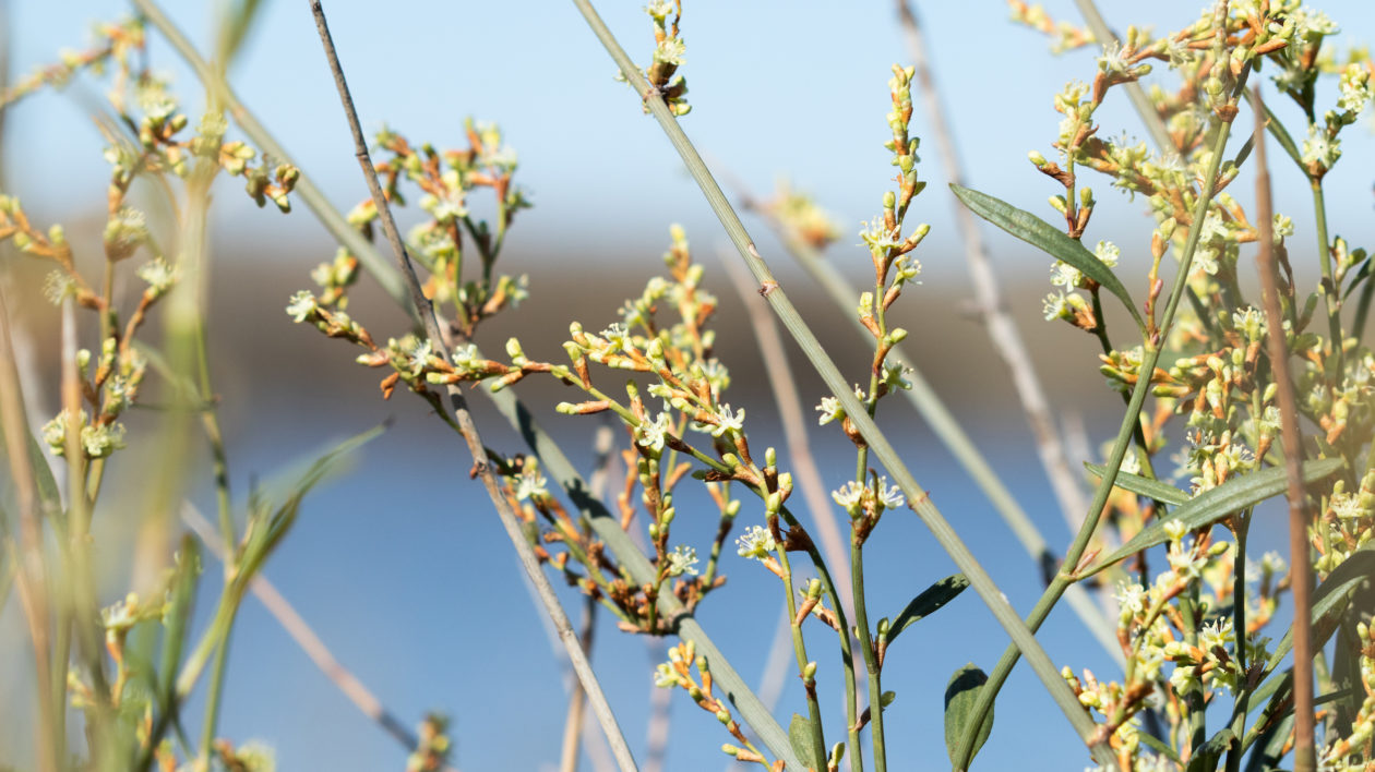
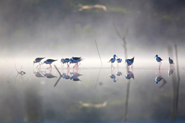
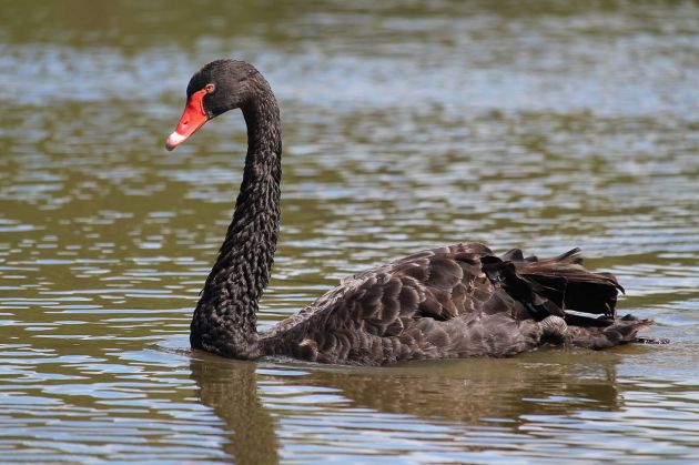
As Jamie adjusts the flow regulators from the control box, Rene and I look out over the wetlands. Countless frogs call from deep within the tangled lignum shrubs, whose wiry, leafless branches glow green with tiny, pea-sized blossoms. Native black swans glide in pairs through the gaps in the vegetation, flocks of long-legged pied stilts parading in their wake. Pointing to the swans, Jamie tells me that they’re an important totem animal for the Nari Nari people.
Sensing my questions, Rene and Jamie explain: Before European settlement, water flowed across this country through a network of small creeks, streams and wetlands, which Rene and Jamie liken to arteries.
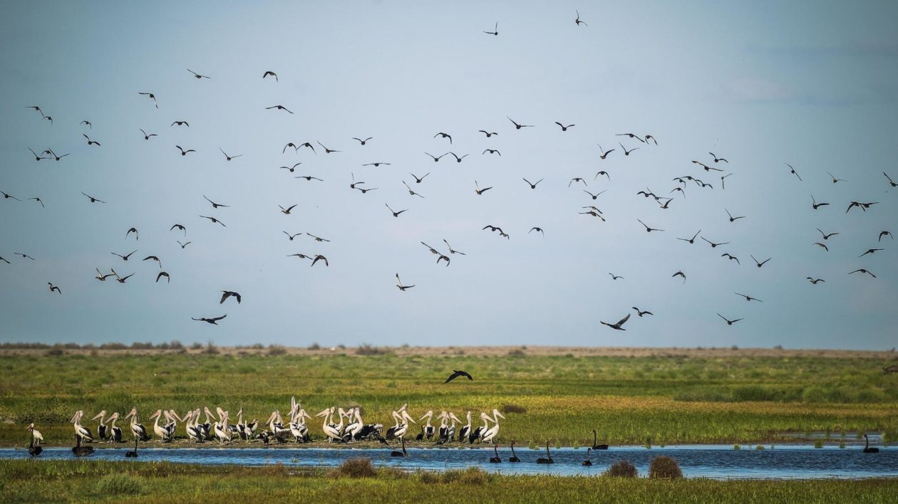
And every few years, after massive rains, the Murrumbidgee River to the north would break its banks and flood out across the country, creating the perfect habitat for water birds. During the floods, tens of thousands of ibis, spoonbills and pelicans descend to breed in giant colonies, building their nests atop the lignum and in the river red gum trees in a raucous, smelly, spectacular event.
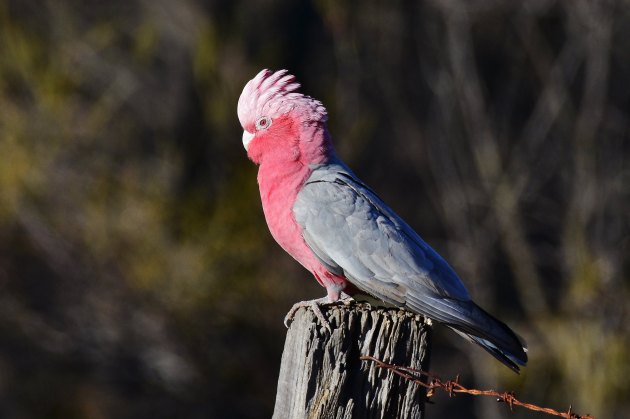
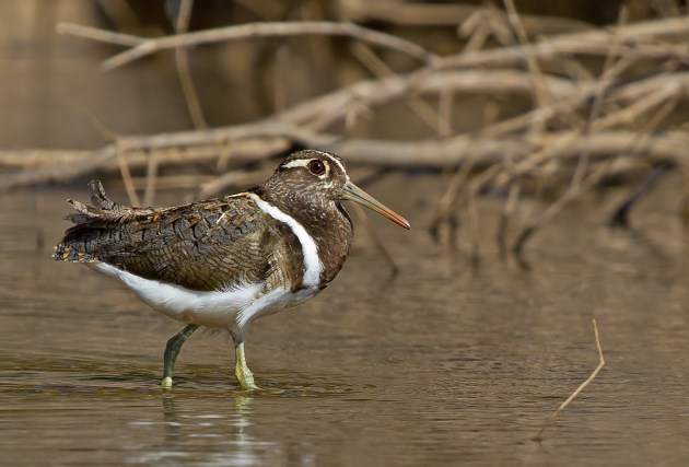
Even in non-flood years, the entire area is a haven for resident birds like galahs (a watermelon-pink cockatoo), white-plumed honeyeaters and the endangered Australian painted snipe.
But these days, hundreds of miles of ditches and embankments built by farmers block the flow of floodwaters and starve the natural wetlands. That all started to change in 2013, Rene says, when 11 landowners sold their land and water rights to the state government. Gayini is now managed by a TNC-led consortium, including the Nari Nari Tribal Council, the Murray Darling Wetlands Working Group, and the University of New South Wales.
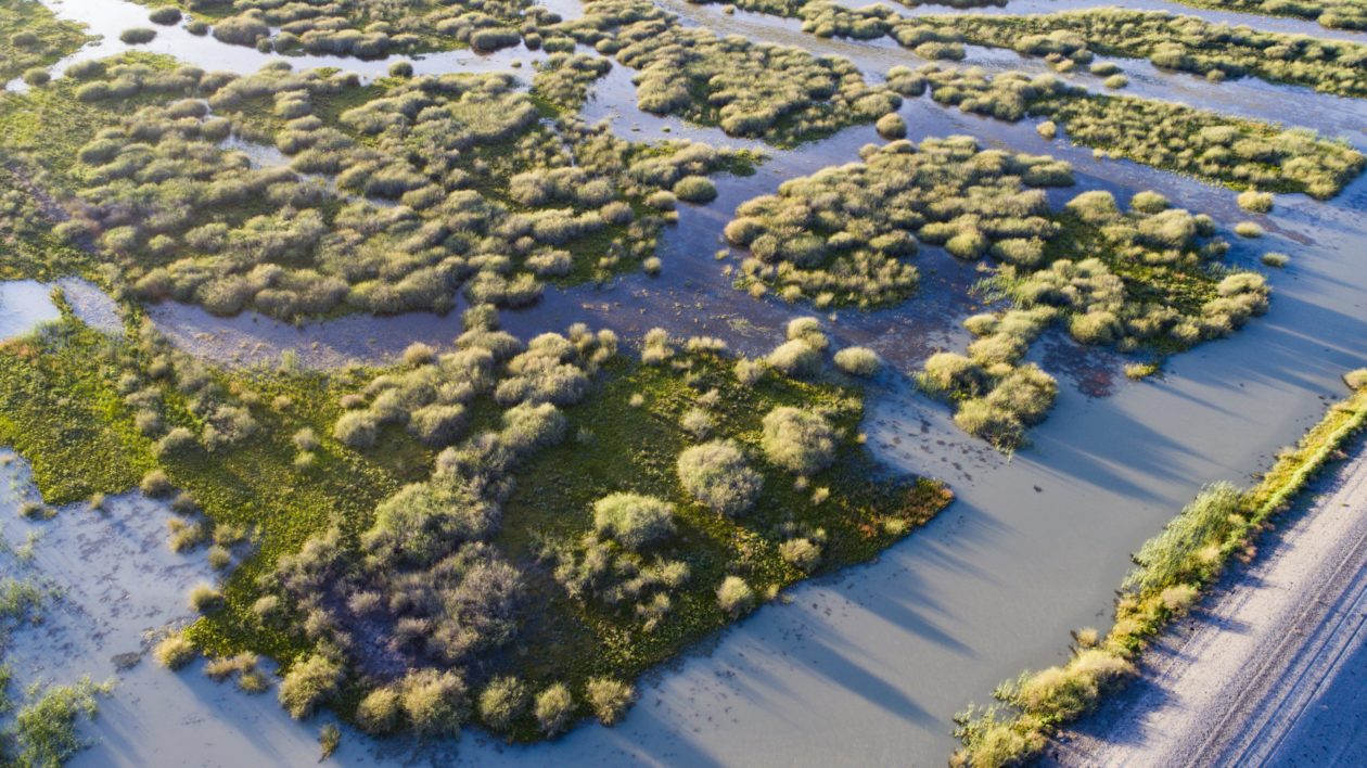
Much of the conservation work at Gayini hinges around recreating natural flows across the landscape by bulldozing hundreds of banks across the property. “The goal is to have water somewhere on the landscape all the time, so the birds have somewhere to stay year-round,” explains Rene.
The brothers tell me that just a few weeks ago, most of the land was brown and bone dry, like the country we passed during our drive. But the land is incredibly resilient. “You just have to treat it right and love it and it will come back,” says Jamie. This water is the first to flow across Gayini since construction ended, and already the country is coming back to life. And when the water returns, Jamie says, so do the birds.
In late 2018, TNC purchased a second critical wetland just north of Gayini: the Great Cumbung, one of the largest reed swamps in southeastern Australia. It was the largest private conservation purchase in Australian history. The swamp is distinctly different from the lignum wetlands of Gayini, with vast stretches of grassy reeds reminiscent of the Florida Everglades.
With philanthropic support from several donors, including the Wyss Foundation, TNC and its partner Tiverton Agriculture purchased both the land and its water rights. The deal was strategic: Not only do Gayini and the Cumbung contain some of the best remaining wetlands in the region, but they both abut Yanga National Park, which protects one of Australia’s largest remaining red gum forests.
And in an unusual arrangement, Rene explains that the conservation work on both properties will be funded in part by sustainable grazing on sections of the land that were already converted to pasture.
Later, Jamie and I drive around the southern end of Gayini as to check where the water is flowing. He stops to show me Lorica Lake; the lakebed is dry, but the trees at its edge are still decorated with hundreds of pelican and cormorant nests from the last flood.
Looking down at my feet, I notice an odd, dark patch of earth covered with small, terra-cotta colored pebbles. “This is a kitchen,” says Jamie, smiling proudly. We’re standing next to the remains of an ancient hearth, where Aboriginal Australians roasted kangaroo, emu and other game in an oven made from fire-heated clay. I kneel down and touch the earth, near speechless.
“Anywhere you walk, fly, or drive in Australia, you’ll find signs of Aboriginal occupation,” says Jamie. “If you know what to look for.” He then points to the low ridge on the other side of the lake, which stays dry even during a flood. “There are a lot of burial mounds up there, on the high country.”
Until now, most of my experience with human history and anthropology has been through in textbooks and museums; viewing carefully arranged artefacts through the glass panes of museum displays. But here, I can reach down and touch that history, tens of thousands of years of human experience beneath the palm of my hand. It’s both awe inspiring and humbling, like looking at the swirls and stars of the Milky Way in a dark night sky.
As we get back in the car, Jamie tells me that this is just one of more than 1,000 cultural sites on Gayini, including hearths, shell middens, trees scarred from bark harvesting, and burial grounds. But after listening to Jamie and Rene, I realize that these sites are not anthropological curiosities — they’re vital touchstones in a living culture.
Aboriginal Australians practice the longest continuous human culture on earth, and the brothers explain that their culture is inextricably tied to the land: without one they cannot have the other. But European settlement disrupted that connection, depriving First Nations people of both culture and country.
But things are changing. Rene and Jamie have visited these places since they were children, walking across the country, practicing their culture, and paying respect to their ancestors buried across the landscape. Gayini is home; the country sustains and fulfills them in a way that no other place can.
Recognizing that deep link to country, the consortium plans to exercise it’s option to purchase the land from the state government. It will be a significant moment: In the Murray-Darling basin, Rene tells me later, Aboriginal Australians own less than 3 percent of the land and less than 1 percent of the water.
As the sun sets on my last day at Gayini, I walk from the small homestead where I’m staying along a tree-lined creek. Galahs chortle from the tree hollows as kangaroo browse quietly in the fields, soaking up the last warmth from the sun.
I’m learning to read the landscape after few days with Jamie and Rene. Looking out on the sun-drenched country, I can pick out the subtle, water-carved depressions, the low sand ridges, and distant creeks marked by gum trees. I see where the water will flow, when the floods come and the birds descend on Gayini.
I think back to the handwritten poster I saw hanging on the homestead wall, left by consortium members when they gathered to discuss their long-term vision for this country: “That the traditional custodians of Gayini heal its lands and waters, and in return, Gayini heals its people.” I believe it.
A version of this story appeared in the Winter 2019 issue of Nature Conservancy Magazine.


_(42722510472).jpg)
_(8470799026).jpg)
Join the Discussion