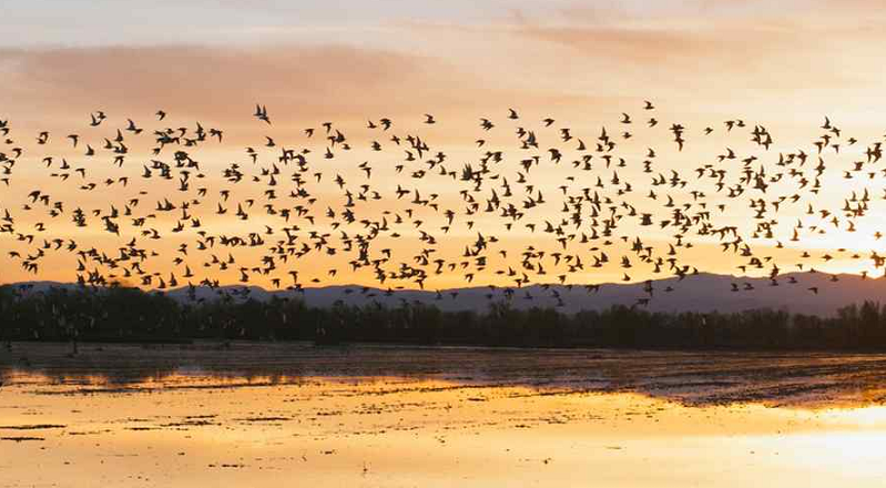
Migrating shorebirds can’t afford to be choosy about where they stop to rest — whether the right habitat is there or not, they can only fly so far and so long. So how can conservationists help these birds, when the wetlands they once used to rest and refuel are now agricultural fields?
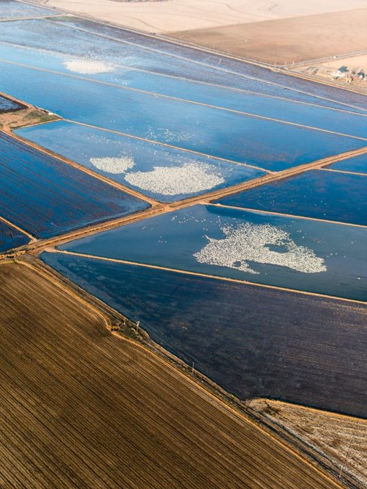
New research shows that an ingenious program to transform rice fields into pop-up wetlands for shorebirds in California’s Central Valley is working, yielding the largest average shorebird densities ever reported for agriculture in the region.
Growing Birds in the Off Season
Much of the produce stacked neatly in grocery coolers or served on your dinner table tonight originated in California’s Central Valley. Spanning nearly 20,000 square miles, the valley produces 8 percent of the United States’ agricultural output by value on just 1 percent of its farmlands.
But there were once wetlands where fields now stand. Between the 1780s and 1980s, the Central Valley lost more than 90 percent of its original wetlands and riparian areas. Bird populations along the flyway fell from 20-40 million waterfowl to just 3-5 million, and those that remain face extreme habitat deficits along their route. The American Bird Conservancy now considers the area to be one of the top 20 most threatened bird habitats in the entire country.
But the birds still come, and they make do with what little habitat remain as they touch down to rest and re-fuel. Previous work by The Nature Conservancy discovered that agricultural lands were meeting 65 percent of migrant birds’ habitat needs when they were in California.

“Before our migratory bird planning, our conservation strategies relied almost completely on land protection and restoration.” says Mark Reynolds, an author on the research and the lead scientist for the dynamic water management at the Conservancy’s California program. “But here was this group of more than 60 species that were telling us that agricultural lands were really important, too.”
Reynolds and his colleagues realized that traditional conservation methods — buying conservation easements on remaining natural areas — were too expensive and time consuming to adequately protect hundreds of thousands of acres of shorebird habitat. And they also weren’t flexible. California already has the highest variation in annual precipitation of any region in North America. That variability is projected to worsen with climate change, potentially leaving many protected lands high and dry.
But they had a solution — renting the habitat.
Using data collated from The Cornell Lab of Ornithology’s eBird program, Conservancy scientists and their partners were able to predict where and when the birds would travel throughout the valley during migration. And by comparing those data with predictions of surface water availability, sourced from NASA data, the scientists were able to figure out that the greatest needs for wetland habitat occurred in February through March, at a time when water availability is extremely low.
With that knowledge, the Conservancy reached out to rice farmers, who typically flood their fields from November through January to help decompose the stubble from the previous crop. Using a reverse auction, where farmers bid for the lowest payment, the Conservancy offered to pay farmers to flood their fields a few weeks early in the fall, and maintain the waters a few weeks longer in spring.
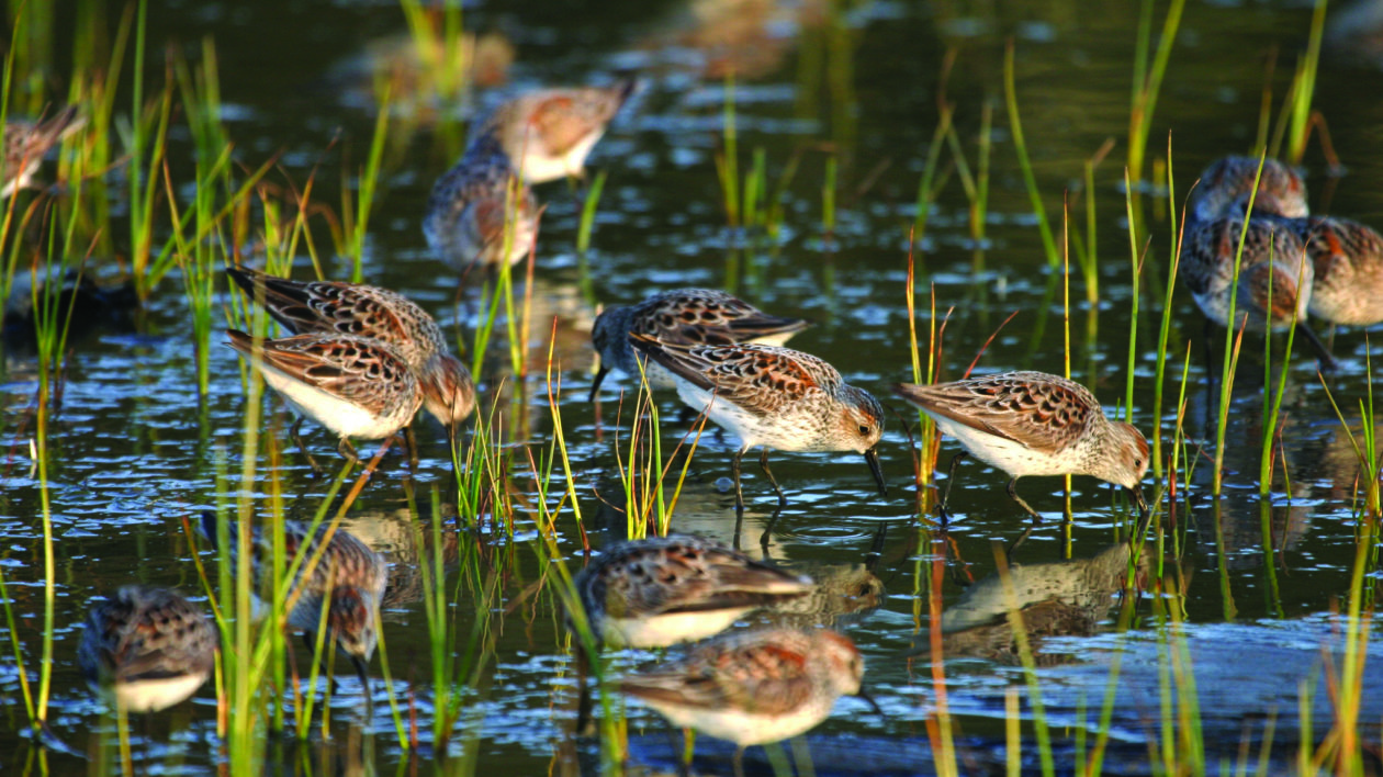
Just 5 to 10 centimeters of water transformed the fields into wetlands, where species like dunlins, sandpipers and long-billed curlew could forage for macroinvertebrates and rest before their next flight.

Measuring the Bumper-Crop of Birds
“This ability to really create habitat on demand is pretty exciting,” says Reynolds, “but we only had the crudest of indications that it would work.” To measure the effectiveness of the program, the Conservancy deployed a network of field technicians to count bird populations at both the pop-up wetlands and at control sites, where farmers continued with their normal practices. After logging more than 6,000 surveys in 2014 and 2015, the researchers used this data to analyze species richness, abundance, and diversity throughout the valley. And they discovered that the wetlands were working.
“It was a very striking response,” says Greg Golet, an applied ecologist at the Conservancy and lead on a portion of the research. “Across all three of those metrics we had significant differences, with the treatment fields having a much greater response in terms of the patterns of shorebird use.”
Their results, recently published in series of papers in Science Advances and Ecological Applications, show that average shorebird density was between 2 and 3.5 times greater on the pop-up wetlands than other fields. And shorebird species richness was also greater, with 19 shorebird species recorded across the BirdReturns fields. Unexpectedly, the pop-up wetlands yielded the largest average shorebird densities ever reported for agriculture in the region.
These data also helped the Conservancy modify the program to provide more habitat when the birds needed it most. Shorebird species richness, density, and diversity were all greatest in fall, when California is at its driest and the amount of available natural habitat is at its lowest.
“By using the combination of predictive models and empirical verification data, we were really able to get very specific about the times of year where we can have the biggest impact and return on our investment,” says Reynolds. In subsequent years, the Conservancy has asked farmers to flood their fields even earlier in the fall, to help species that migrate very early in the season.

To compare the economics, Conservancy economist Eric Hallstein and colleagues ran a cost-benefit analysis to compare how the expense of the program compared to traditional conservation methods. With BirdReturns, the highest possible cost to provide 38.9 square kilometers of wetland habitat for 8 weeks was $1.4 million USD. Meanwhile, the cost to purchase that same amount of land, retire it from rice production, and restore it to bird habitat would be a staggering $175 million, with an additional annual maintenance cost of $100,000. Even at its most expensive, renting habitat through BirdReturns costs less than 10 percent of the price to buy the land outright.
Even so, Reynolds says that cost savings is only part of BirdReturns’ advantage — another key value is the program’s flexibility.
BirdReturns started in the winter of 2014-2015, in the midst of the worst drought in California’s history. “The waterfowl models were predicting catastrophic die-offs,” says Reynolds. But BirdReturns inspired conservationists as well as state and federal agencies to expand wetland habitats and help compensate for the effects of the drought. Then just two years later, in the winter of 2016-2017, California had an unusually wet winter. The adaptability of BirdReturns allowed the Conservancy to scale back the program to adapt to the abundance of wetland habitat.
Reynolds hopes that the program could be even more flexible in the future. “We’re getting better at these predictive models, and not long from now we can look at the migration patterns and try to position habitat to be there when the birds get there and when they need it.”
While nothing replaces permanent land protection, flexible approaches like BirdReturns can move with the birds, creating habitat on demand, where and when migratory species need it most.


What a brilliant idea. This Bird Rent concept could be extended to other areas of conservation, e.g. paying farmers to leave cereal stubble in fields for a little longer into the fall to help migrating birds traveling south for the winter.
Extremely interesting and positive.
Hopefully this template will be expanded.
Great work by TNC and partners. This is innovative, smart, and really takes advantage of available data and tech.
I’m really curious about the other benefits of these programs. Do farmers see any other changes in how their fields work? Does the presence of the birds affect crop yields, soil health, etc.?
this is just spectacular, a real modern miracle! Thank you to everyone who worked on this project!
Thank you for this article- nice to see some good news about
a successful conservation program that will help restore the number of shoreline birds and also an abundance of species, while being extremely cost effective…it’s genius!
Fascinating article. Good minds with universal thinking are so needed today with climate change and
ignorance looming.
Very cool article and great idea; pop up wetlands! Love that.
I volunteer for Audubon at the Ballona Wetlands for their docent programs (and other things) which includes school field trips that come to the wetlands for a walk and some education. We talk about migration and the loss of wetlands so this would be a fun thing to add to the conversation!
Thank you!
1) If “the greatest needs for wetland habitat occurred in February through March”, why do you need flooding “a few weeks early in the fall”? Why not only “a few weeks longer in spring”?
2) “the pop-up wetlands yielded the largest average shorebird densities” – has anyone found the optimum density? – if the shorebirds thrive in densely packed areas, perhaps less land is required … or having the same total area but in smaller plots scattered over larger areas
3) What is the optimum number of birds for each of the 19 species of shorebirds? Presumably an overpopulation is just as dangerous to each species as underpopulation
I love that this is a bonus for the farmers, too. Making them partners in conservation is a great thing.
This is just amazing and fills me with joy that there’s still hope for the birds.
With so much discouraging news, this article amazes with its creativity and do-ability. My thanks to the many who make these projects possible, including writing the story so that even more folks can experience real hope in this, The Year of the Bird.
Fantastic to read about this & why I support your organization…thank you!
I’m trying to get more information about the ivory billed woodpecker.
I believe that I saw one 2/13/2018 in our woods (Darke county, ohio)
The red crest and head, large bird, 18-20 imch size , longish neck, white or light underbody, in tree. Distinct call that sounded like a model-T horn. NOT a pileated because it had too much white on the underbody.
Hi Constance, Thank you for your interest! The Cornell Lab of Ornithology has a page for identifying ivory-billed woodpeckers and reporting potential sightings: http://www.birds.cornell.edu/ivory/identifying/index_html
Excellent program, kudos to Nature Conservancy in finding such a seemingly simple solution to supporting migrating birds!
One of the reasons I support the Nature Conservancy is it’s realistic economic decisions. I want the money to go as far as it can!