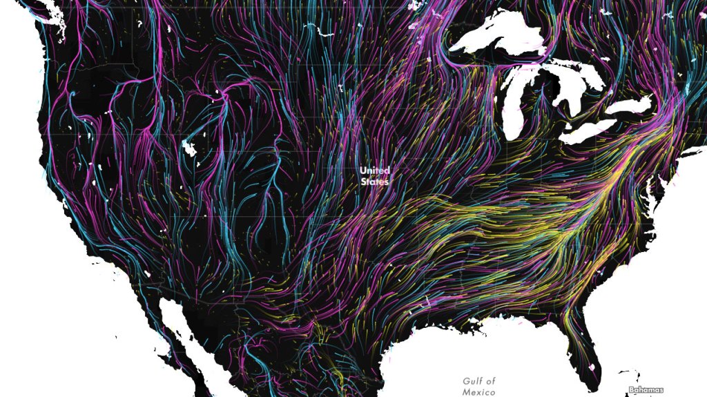
As climate change alters habitats and disrupts ecosystems, where will animals move to survive? And will human development prevent them from getting there?
Now you can see those migrations in motion.
New research from Conservancy and university scientists revealed that only 41 percent of the natural land area in the United States retains enough connectivity to facilitate species tracking their preferred climate conditions as the global climate changes. As part of that study, scientists modeled the distribution and habitat needs of 2,903 vertebrate species in the Western hemisphere against land use and projected climate patterns.
Previous work mapped the geographic areas in the western hemisphere through which species will likely need to move to track their suitable climates. That study identified that the Amazon Basin, southeastern United States and southeastern Brazil are three areas with projected high densities of climate-driven movements.
Conservancy cartographer and analyst Dan Majka brought this data to life in a series of maps that show what corridors mammals, amphibians, and other animals will use as they move to new habitats under projected climate change. Inspired by wind maps of the United States, and using code from Earth global wind map, adapted by Chris Helm, Majka’s dynamic map allows scientists and the public to see the continent-wide impact of climate change on animals and visualize corridors they will need to move.
Check out the map above, and use the navigation tools in the upper-right to investigate migration patterns in both North and South America.


Every human has to have a role in conservation of nature and the is need for team work wiht the researchers in this process. participatory innovations are to be initiated with parks personel and dwellers of different areas, tracking of migrating habitants should also be doen as a measure to conserve most of the birds and animals within these dwellings.
Talking about migration patterns in the face of climate change is definitely something I am interested in discussing and learning further. The Benue valley in Nigeria and indeed the trough across the area is currently being ravaged by the herders of cattle in search for grazing areas which in turn affects the local farmers. This, I would like to know more about finding lasting solutions to these impacts.
Excellent Job, greetings from Costa Rica!
what animals are those that are migrating
My grattitude for all you do to save our wonderful planet.
What can we humans do to help? I know some places have and are hopefully building more animal bridges to help cougars and such get over interstates and bridges. I know using less electricity and fossil fuels will help slow down climate change. cant believe we live in thumpgang land who don’t understand or care what they do to the earth and its inhabitant’s.
Two of the most common recommendations I see are to take down or modify fences where they aren’t necessary and to conserve more corridors between areas that are already protected. You might be interested in this post with more detail: https://blog.nature.org/2016/06/29/species-on-the-move-mapping-barriers-for-wildlife-in-a-warming-world/ or this one specifically on fencing options: https://blog.nature.org/2017/06/26/how-pronghorn-cross-fence-wildlife-connectivity/
A very hypothetical map, but interesting to view. Good visual reminder of basic biogeographical principals, but I don’t expect the armadillos will make it to Nova Scotia.
I would have liked to see Australia and other continents, besides the Americas, modeled.
Thanks,
Cheers
Justine, love the graphic. Do you have similar for fish?
Thanks, Denise Wagner