New research shows that common solar datasets underestimate land use by up to 34% because they ignore the footprint of the entire facility. That gap hides the true scale of habitat loss, especially in natural areas like shrublands.
The Gist
Published in the Journal of Environmental Management, the research tackles a critical but underexplored issue: how we measure the land footprint of utility-scale solar projects and what that means for land-use change. The authors compare three spatial datasets—two that map only the photovoltaic array area and one (Wiki-Solar) that includes the entire fenced facility footprint.
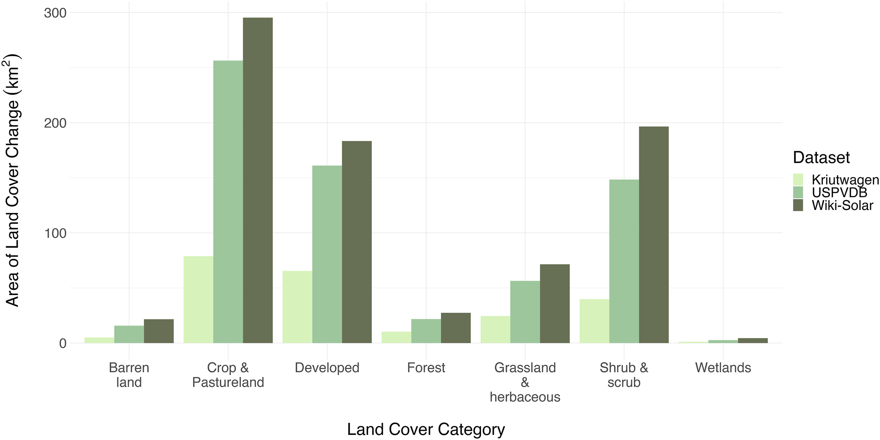
The findings are striking: estimates based on array-only datasets understate the true footprint by up to 34% compared to the fenceline-based dataset. This discrepancy matters because it influences calculations of land-cover conversion, particularly the loss of natural and semi-natural habitats like shrublands. In short, the way we define “footprint” shapes our understanding of solar’s ecological impact.
The Big Picture
Energy demand in the United States is beginning to skyrocket. No single energy technology can meet this demand alone—clean energy must be part of the buildout. But to quickly build the clean and renewable energy we need, it must be done in ways that are best for nature and people.
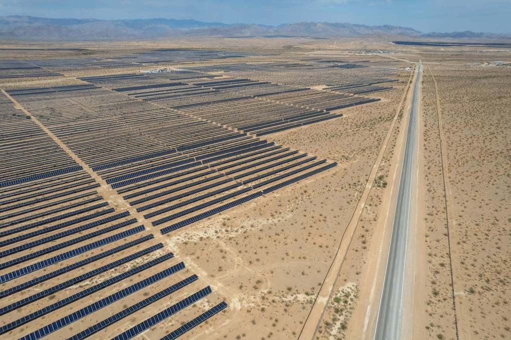
Solar energy, especially ground-mounted photovoltaic (GPV) facilities, is proving to be an important part of the solution. Yet, building GPV facilities can be land-intensive. That is why The Nature Conservancy is interested in researching the true footprint of GPV, to better understand impacts to nature and ultimately minimize those impacts. Unfortunately, spatially explicit datasets on solar footprints have been scarce and inconsistent. Public datasets often capture only the array area, ignoring roads, substations, and buffer zones within the facility fence. These omissions lead to systematic underestimation of land requirements and, by extension, underestimate the true scale of land-cover change.
The authors analyzed three datasets to quantify these differences and assess land conversion trends. Their results show that when the full facility footprint is considered, solar development converts more undisturbed land types than previously recognized. For example, shrub/scrub habitats—important for biodiversity—are disproportionately affected. This nuance is lost when relying on array-only datasets, which tend to suggest a smaller and less impactful footprint.
From a conservation standpoint, this matters because land-use decisions hinge on accurate data. Underestimating solar’s spatial footprint could lead to flawed siting strategies, missed opportunities for co-location with disturbed lands, and unintended biodiversity impacts. As solar energy development expands to meet climate targets, these trade-offs will intensify, making robust, transparent datasets essential for balancing renewable energy expansion with ecological integrity.

“Biodiversity will only factor into solar development if conservation data can keep pace with development,” says lead author and former TNC NatureNet Fellow Michael Levin. “If we don’t have that information, and if it isn’t accessible and easy to use, the sheer pace of solar build-out will leave us behind.”
The Takeaway
“This study underscores a simple but powerful point,” says co-author, Liz Kalies, Lead Renewable Energy Scientist for TNC North America. “Definitions drive decisions. If policymakers, planners, and conservationists rely on datasets that only capture panel arrays, they risk underestimating solar’s land demand and its ecological footprint.”
The Wiki-Solar dataset, which accounts for the entire fenced area, offers a more realistic basis for assessing land-use change and planning mitigation strategies. However, it is proprietary and less accessible, highlighting a broader challenge—data transparency.
For conservation practitioners, note the authors, the implications are clear:
- Advocate for standardized, open-access spatial data that reflect full facility footprints.
- Integrate land-cover change analysis into renewable energy planning, ensuring that siting avoids high-value habitats.
- Communicate the trade-offs: solar is vital for climate goals, but its expansion must be managed to minimize biodiversity loss.
Solar development is not just an energy story; it’s a land story. Recognizing the true footprint is the first step toward solutions that accelerate the clean energy buildout we need while minimizing impacts to nature.


