Africa’s Great Lakes stretch in an 1,800-mile curve of 11 countries from Ethiopia in the north to Malawi in the south, encompassing a region rich in biodiversity with nearly a third of the world’s fresh surface water and supporting the livelihoods of 80 million Africans.
The natural bounty the seven lakes provide to both people and planet is under threat. Increasing human populations eking a living from the land in areas of deep poverty are driving rapid and often unplanned development that has major environmental impacts on the lakes, their habitat and resources.
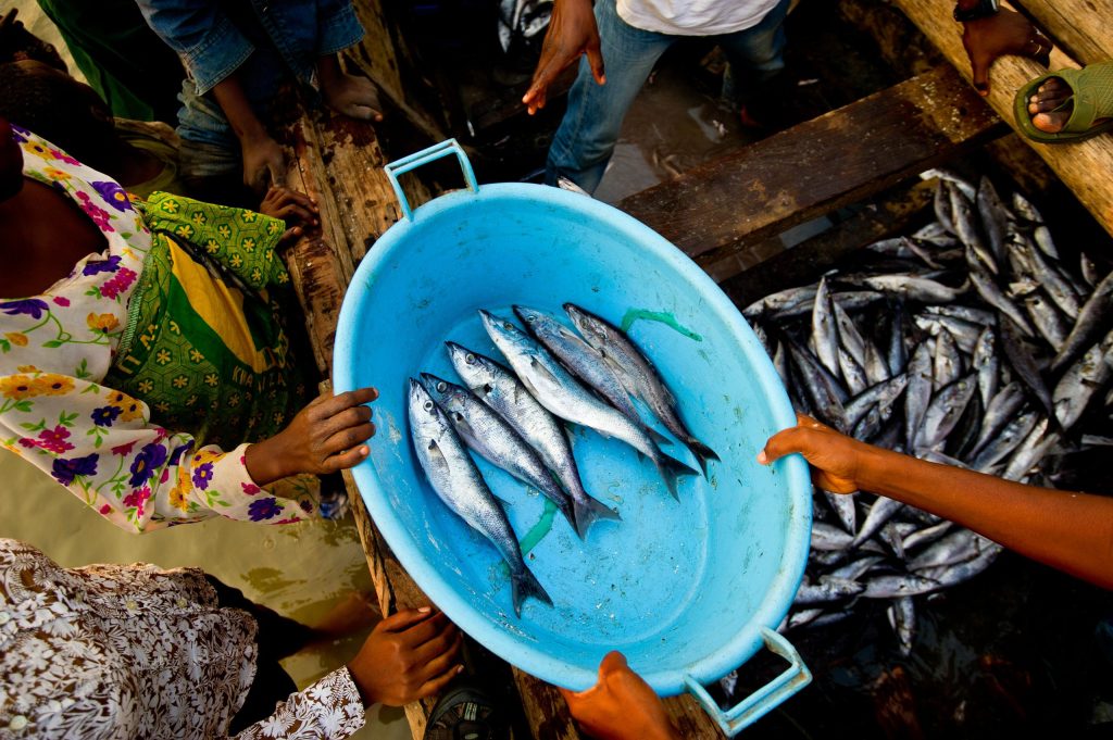
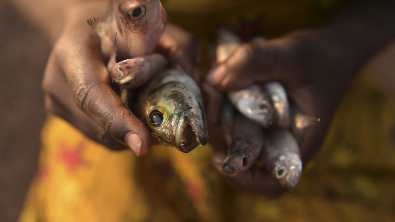
At the heart of the lakes’ economies are their fisheries. They hold the highest diversity of freshwater species of ecological, economic, and scientific importance on Earth, with at least 2,500 fish species, predominantly endemic cichlids.
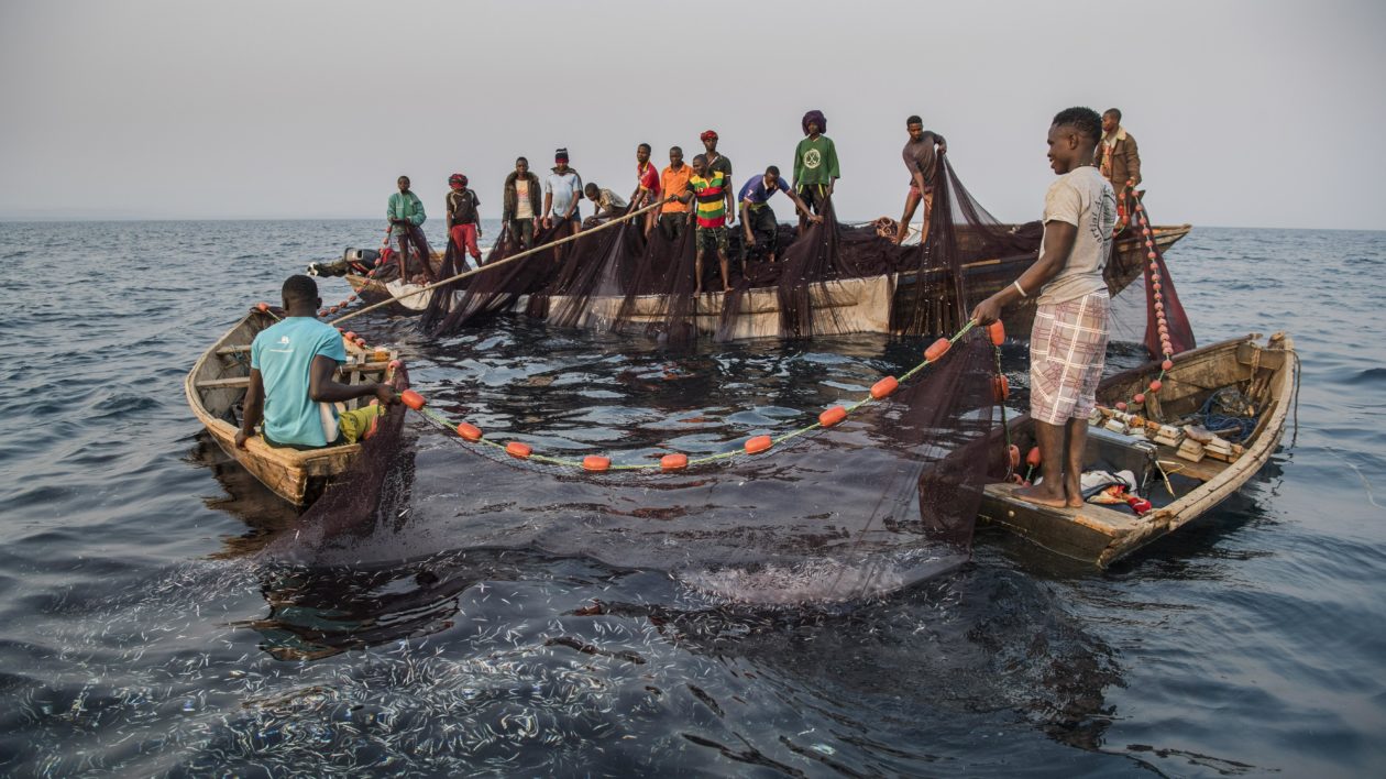
On Lake Victoria, the largest by surface area, some 200,000 fishers catch in the region of one million tonnes of fish a year, driving businesses that support a further four million people to earn a living.
Already, stocks of many large commercially-important species have declined or even collapsed from over-fishing and environmental degradation. For example, due to historic commercial fishing, the three largest Lates (perch) species are rarely caught today on Lake Tanganyika.
Written on the Beach
To stop the same happening to the stocks that remain, authorities need affordable ways to keep track of what is happening with fish catches across all seven lakes: Albert, Edward, Kivu, Tanganyika, Turkana, Victoria, and Malawi, also known as Lake Nyasa and Lake Niassa.
Historically, gathering and analysing data from the lakes was a costly, time-consuming process fraught with risks of human error warping results, says Innocent Sailale, senior data systems analyst for the Tanzania Fisheries Research Institute (TAFIRI). The Institute produces regular reports on the country’s fisheries sector to support policy-making by the national Fisheries Department in the Ministry of Natural Resources and Tourism.
“It was all manual, all on paper,” Mr. Sailale says. “Data from the fishers was written down at the beach, it would get wet and you struggle to read it later. The papers piled up and were stored somewhere until the scientists came from the Institute or the Ministry to collect them, and they sometimes couldn’t be found. People could even fill out fake data sitting at their home not ever going to the beach. Data entry errors were common.”
If scientists or the government wanted new research, a team would need to travel to the lake to update the enumerators on the information they would need to collect. These trips cost too much for strapped ministry budgets, meaning new science that could have informed smart policies never got off the ground in time.
Even problems identified in the data that were captured were sometimes only noticed months later when the manual forms were collected and transported to the labs, painstakingly entered into computer spreadsheets, and analysed.
“You come to understand the issue when it’s already too late, or become something else,” Mr. Sailale says.
What this all meant was that the authorities tasked with sustaining the economic and ecological resources of Africa’s Great Lakes were in many cases flying blind.
“If you inadequately monitor these fisheries resources, successful and sustainable management cannot take place in a timely manner,” says Dr. Richard Ogutu-Ohwayo, who has studied and worked on Africa’s Great Lakes for over 40 years and is currently the Executive Director of AFLANET, the African Lakes Network.
“Inadequate monitoring has partly contributed to the decline in fish stocks. Availability of catch and effort data is critical in sustainable fisheries management, and it requires good, timely, and affordable. E-CAS was developed to achieve that.”
Capture the Data
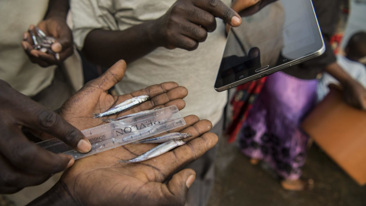
E-CAS stands for Electronic Catch Assessment Survey. It is a digital data capture and analysis system run through an Android app loaded to mobile phones where data is collected and sent in real time to a cloud database accessible by stakeholders for instant analysis and reporting.
It was developed to monitor the fisheries in the Tanzanian waters of Lake Tanganyika with a $110,000 grant from the African Great Lakes Conservation Fund, administered by The Nature Conservancy (TNC) with a $500,000 donation from the John D. and Katherine T. MacArthur Foundation.
The Fund was launched in 2017 at the African Great Lakes Conference in Entebbe, Uganda, the first major technical, scientific, political, and development gathering for the region’s freshwater lakes in more than 20 years. TNC was the lead organizer for this conference.
The MacArthur Foundation grant provided catalytic support under the African Great Lakes conservation fund to implement some of the key recommendations from the Conference, following on its support for the conference itself.
Alongside e-CAS, the Fund supported a regional online information platform; regional policy and research coordination workshops through the African Center for Aquatic Research and Education (ACARE); a compendium of best management practices for in-lake caged aquaculture; and a program to reduce sedimentation through sustainable land use management in Rwanda and Burundi.
“The success of the African Great Lakes Conference demonstrated an enthusiasm for regional coordination and problem solving, but there was a clear gap in facilitating this to happen,” says Colin Apse, Africa Freshwater Conservation Director for TNC.
“The African Great Lakes Conservation Fund helped to fill some of the gap in sharing and developing best practice to benefit the environment and developing economies in and around the lakes, and the resources the lakes hold.”
The electronic fish catch assessment system is already having a significant impact, and is set to be expanded to other great lakes, says Dr. Ogutu-Ohwayo, who has worked closely with TNC’s Africa Great Lakes Initiative.
“E-CAS has really simplified how we do business in the fisheries sector, and it’s helping us a lot,” he says. “It speeds up the availability of data. It leaves scientists in the laboratory analysing data and advising managers, not travelling all the time to and from the field. It cleans the data as it’s generated, removing unnecessary errors. It’s instantly updated as improvements are developed or new research requirements are identified.”
Already, the authorities using e-CAS report the cost of monitoring fish catches has dropped by 70% since the system was introduced. Managers are able to plan amendments to policies or guidelines using the most up-to-date information.
Those data can also be shared with the national authorities or partners including donors to help refine development funding to the fisheries sector so it is as effective as it can be.
Just as important is that e-CAS involves people at all levels, from the central government all the way down the chain to the fishers on the lakes, says Dr Hillary Mrosso, Senior Research Officer at TAFIRI who worked with TNC to pilot e-CAS in Tanzania.
“It solves problems the scientists faced, but it also helps the communities,” says Dr. Mrosso. “The data comes right from the hands of the fishermen, and the system can feed back to them and authorised people at different levels. Analysis can be produced without having to wait for a national or regional report, even eventually to the village level so they would be able to tell what they’re catching and set up their plans on the basis of such kinds of data.”
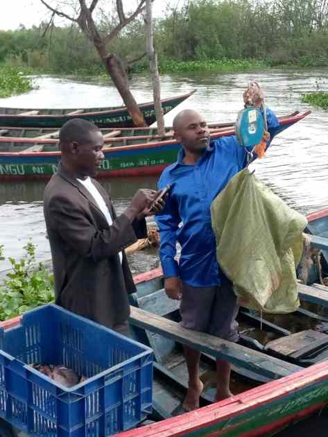
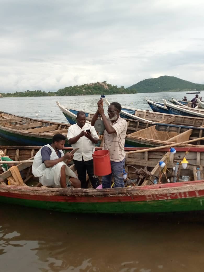
The system works like this. Enumerators are picked from the fishing communities – usually fishers with a role in the local Beach Management Unit (BMU) – or from the district authorities. The e-CAS app is loaded to mobile phones running the Android operating system. Its simple interface encourages easy data entry.
Four groups of data are collected. First, where the fish were caught and where the catch was brought ashore. The handsets are GPS-enabled, and automatically record the location where data was collected making this information precise and impossible to fake.
Second, details of the fishing boat: What shape and size is it? Is it oar-powered or does it have an engine? Inboard or outboard? What size engine? How many crew are onboard?
Then, data on the fishing gear and equipment: what number and type of nets? What lines, and hooks? Was the gear used in a stationary fishing site or was it drifting?
Finally, measurements on the catch itself: what species of fish and what weight of each, and what was their estimated value either if they were sold where they were landed, or were due to be transported and sold elsewhere?
Fishers feel a greater sense of ‘owning’ their fisheries, Dr. Mrosso says, when they are actively engaged in collecting the data and then see the results of the analysis.
“Take an example of the fisher at the grass roots, they may not have understood, ‘Why should I not go out beach seining, for example, or use a monofilament’, because they don’t see the impact in tangible terms,” he says.
“But with this system they can look at the trends in their own village, and see, ‘when we changed our behaviour in this direction or the other, what happened’? They can see, ‘in the years when we had so many under-sized gill nets, or so many monofilaments, which are destructive, what was the pattern in our catches?’. It has quite a huge impact.”
Using the African Great Lakes Conservation Fund grant and working with TNC through the Tuungane Project, e-CAS was first launched in Tanzania on Lake Tanganyika and the country’s marine coast. The German government’s international development agency GIZ then expanded e-CAS to Lake Victoria, encompassing Tanzania, Kenya, and Uganda.
In Tanzania, 299 people have been trained to collect, store, and analyse e-CAS data. In Kenya and Uganda, 28 system administrators, managers, and supervisors have been trained. The system is being introduced to other African Great lakes such as Albert and Edward.
The goal now, Dr. Ogutu-Ohwayo says, is to expand the system even further. “The issues facing the Great Lakes are essentially the same,” he says. “Here we have a system that is very flexible, it is digital, it can be updated how we want, and it has already expanded from where it started on Lake Tanganyika and now is in Lake Victoria and other lakes such as Albert and Edward.
“It can also be adapted in other fisheries data collections systems such as frame surveys. Next it should go to all the Great Lakes to bring its benefits to each of them as well and developed for other fisheries management data collection.”


Congratulations to the team for this great progress. I really feel proud to acknowledge my Father Dr. Hillary Mrosso as one of the team”The senior Research officer at TAFIR”I. I witnessed his efforts day and night to accomplish these great results of developing e-CAS.
Great effort. Many congratulations to everybody who participated in one or another in supporting and developing e -CAS. This will take the fisheries in African Great Lakes at another level where reliable data can be accessed and eventually lead into proper policy recommendations.