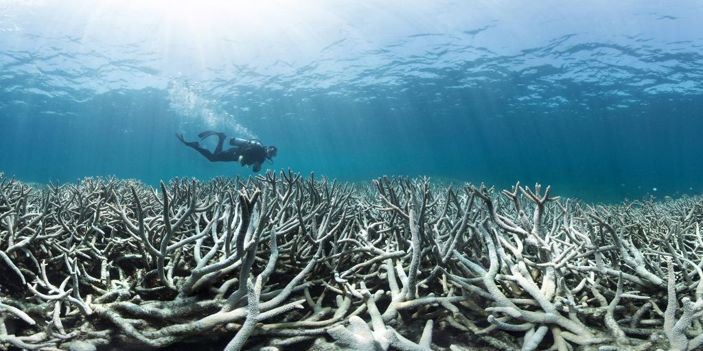
Coral bleaching tends to dominate headlines about Australia’s Great Barrier Reef, with photos of withering white corals stretching as far as the eye can see. Though bleaching is a critical concern, perhaps the most dangerous threat lurks on the hillsides of Queensland, seemingly far away from the reef itself.
With every thunderstorm, tons of sediment and nutrients wash out of sugarcane fields and cleared forest, eventually flowing into the ocean. Like gasoline on a fire, this pollution is amplifying other threats to the Great Barrier Reef, putting the ecosystem in jeopardy.
Land and Sea
The Great Barrier Reef stretches along Australia’s northeastern coast, a spine of 3,800 submerged reefs and atolls arcing through the Coral Sea. Together, they form the largest living structure on Earth. On land, a similar arc of green forests traces the northern Queensland coastline, where ancient rainforests near the coast gradually give way to melaleuca thickets and eucalypt woodlands.
Few people outside of Australia know that these woodlands are a global deforestation hotspot. Nearly a decade of lax regulations allowed landowners to clear trees at a breakneck pace to make way for cattle pasture and crops. In 2015 to 2016, nearly 400,000 hectares disappeared, which amounts to about two-thirds the rate of deforestation in the Brazilian Amazon.
And as so often happens, one environmental crisis begets another.
Without tree roots to secure the topsoil, widespread erosion soon follows. Northern Australia’s torrential wet-season rains carve 10-meter-deep gullies into the landscape, washing an estimated 17 million tonnes of sediment each year into the rivers and, eventually, out onto the Great Barrier Reef (GBR). Research shows that sediment loads at the river mouths increased between 5 and 9 times since European settlers arrived more than 200 years ago.
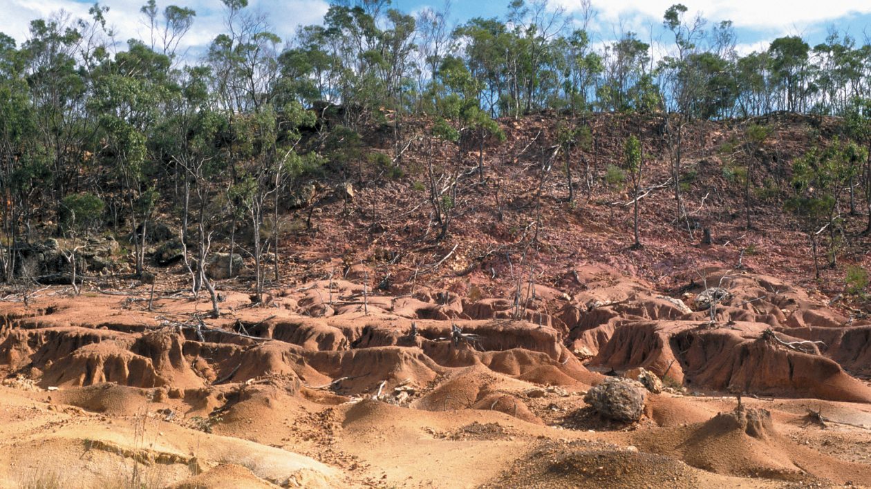
“Erosion increases the amount of nutrients naturally leaching out of the soil,” says Nick Wolff, a climate change scientist at The Nature Conservancy. “And much of the agriculture in the region is sugarcane and banana, which unfortunately are very nutrient-intensive crops, and some of those fertilizers run into the rivers.” In addition to sediments, scientists estimate that 80,000 tonnes of nitrogen and 16,000 tonnes of phosphorus are washed downstream each year. The footprint of nutrient-enriched waters on the GBR has increased by a factor of 10 to 20 since European settlement.
Once those pollutants reach the ocean, they wreak subtle havoc with the reef’s delicate ecosystem. On the 700 or so reefs close to land, silt and clay can literally smother corals, either by covering them in a blanket of fine particles or by clouding the water and hindering photosynthesis.
And instead of dissipating within a few days or weeks, new research indicates that those sediments can linger on the reef for months. In some places, sediments are churned up and resuspended in the water many, many times. “This can reduced water clarity for up to 4 to 8 months even on middle and outer shelf reefs,” explains Katharina Fabricius, a coral reef scientist with the Australian Institute for Marine Science.
The offshore reefs aren’t safe either, as nutrients fuel devastating outbreaks of a coral-devouring predator: the crown-of-thorns starfish.
The Reef Killer
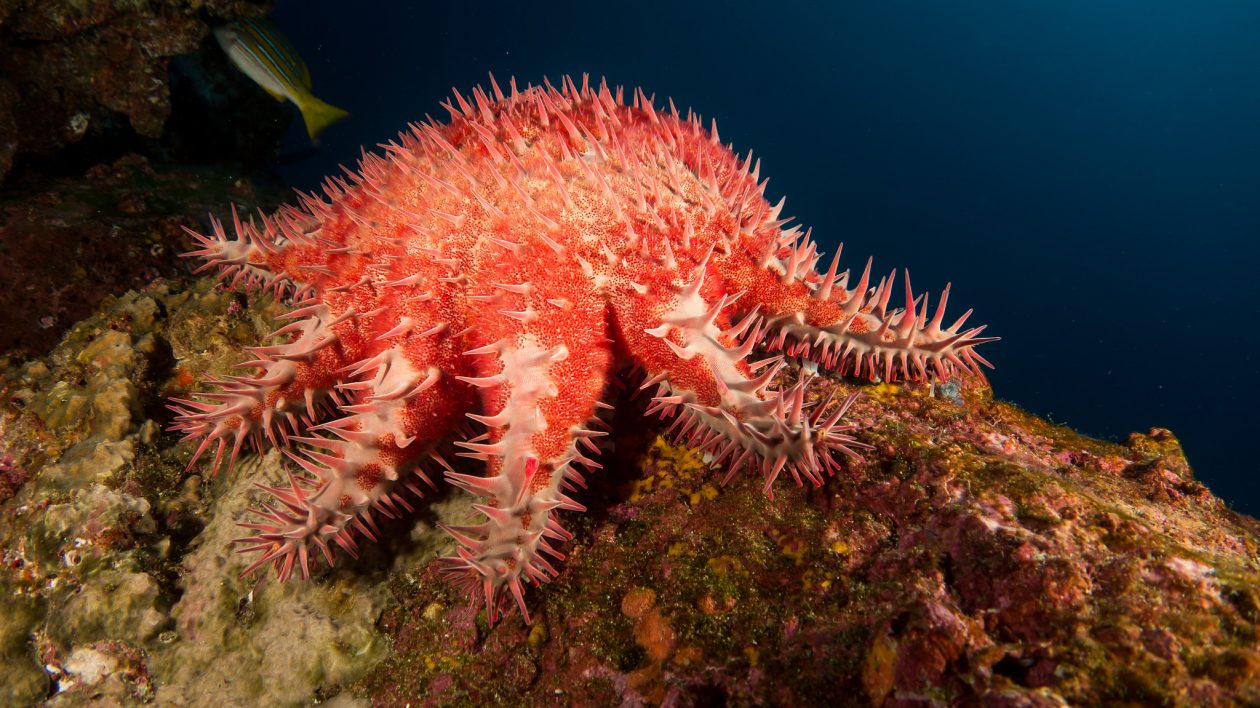
The crown-of-thorns starfish (COTS) is a massive, multi-armed coral killer. With up to 21 prehensile arms, a 14-inch-wide body, and poisonous spines that rival a porcupine, these starfish scuttle their way across reefs eating coral polyps in their path.
When a starfish latches onto a piece of coral, it extrudes its own stomach out through its mouth. It secretes digestive enzymes to liquify the coral tissue, which is absorbed through the stomach tissue. Then the starfish re-swallows its stomach and moves on.
COTS are native to Australian waters, and as long as the population is kept in check they don’t cause undue harm to the reef. But once every 15 years or so — usually after a period of flooding on land — their numbers explode out of control. And that’s where pollution comes in. “There is very good evidence that excess nutrients lead to more frequent and more severe outbreaks of COTS,” says Wolff.
The rain washed down from agricultural lands is rich in nutrients like nitrogen and phosphorous. High nutrient levels fuel phytoplankton blooms, providing an overabundance of food for the tiny starfish larvae and ensuring that many more of them survive than usual. Computer models show that the frequency of these outbreaks has likely increased from one every 50 to 80 years before European settlement, to the current frequency of one outbreak every 15 years or so.
Nutrients aren’t the only factor driving COTS outbreaks — removal of native predators is also a problem — but they are a significant contributor. Tellingly, the COTS outbreaks usually originate on the reefs offshore of the major agricultural areas between Cooktown and Cairns. Currents carry the larvae from reef to reef, where they mature and release another wave of surplus larvae.
The invasion is slow, but within 10 to 15 years the outbreak can spread across 20 to 30 percent of the reef. Right now the reef is enduring the final throes of the most recent outbreak, which began around 2010.
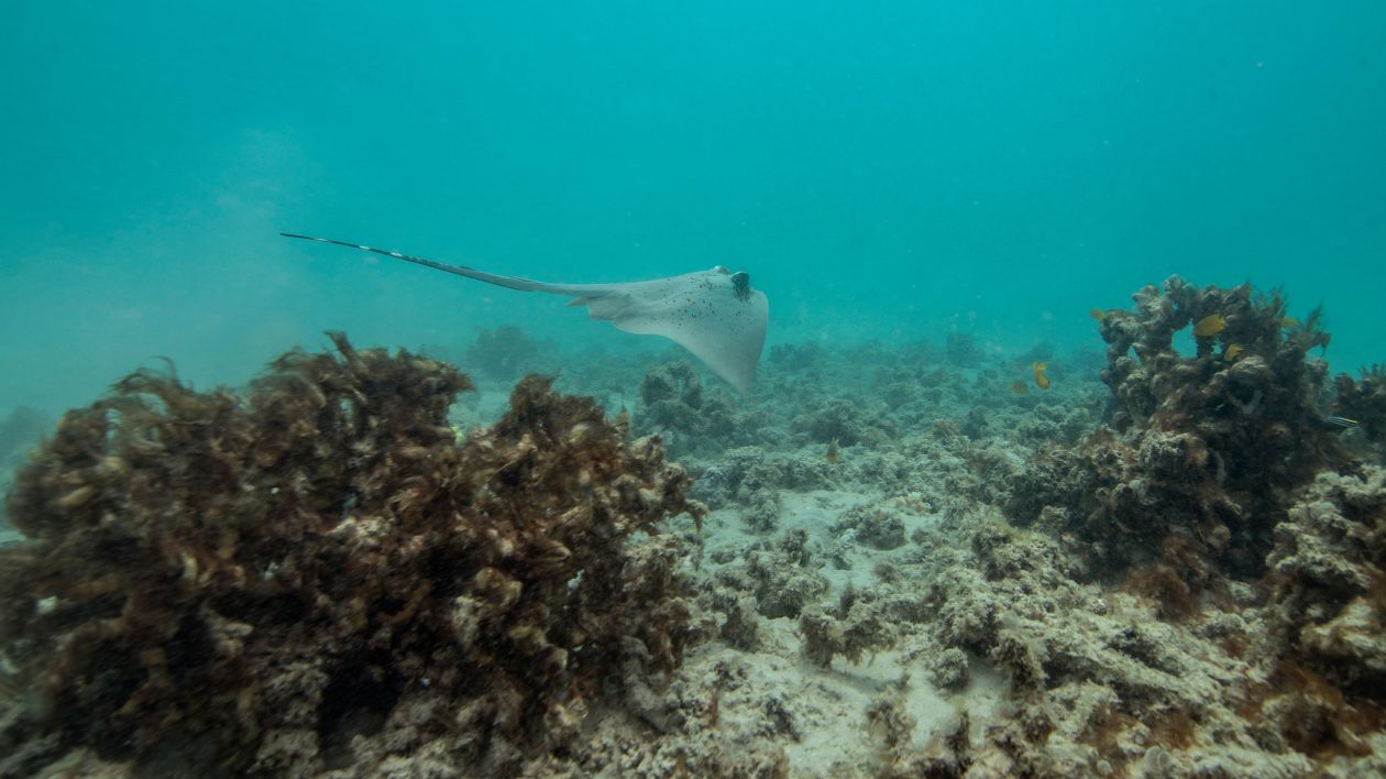
As if smothering and starfish outbreaks weren’t enough, nutrient-enriched river plumes pack a final punch for corals by making them more vulnerable to another major reef threat: coral bleaching. Research shows that elevated nutrients reduce corals’ thermal tolerance by between 1 and 2 degrees Celsius, making them less resistant to the widespread bleaching currently plaguing the reef.
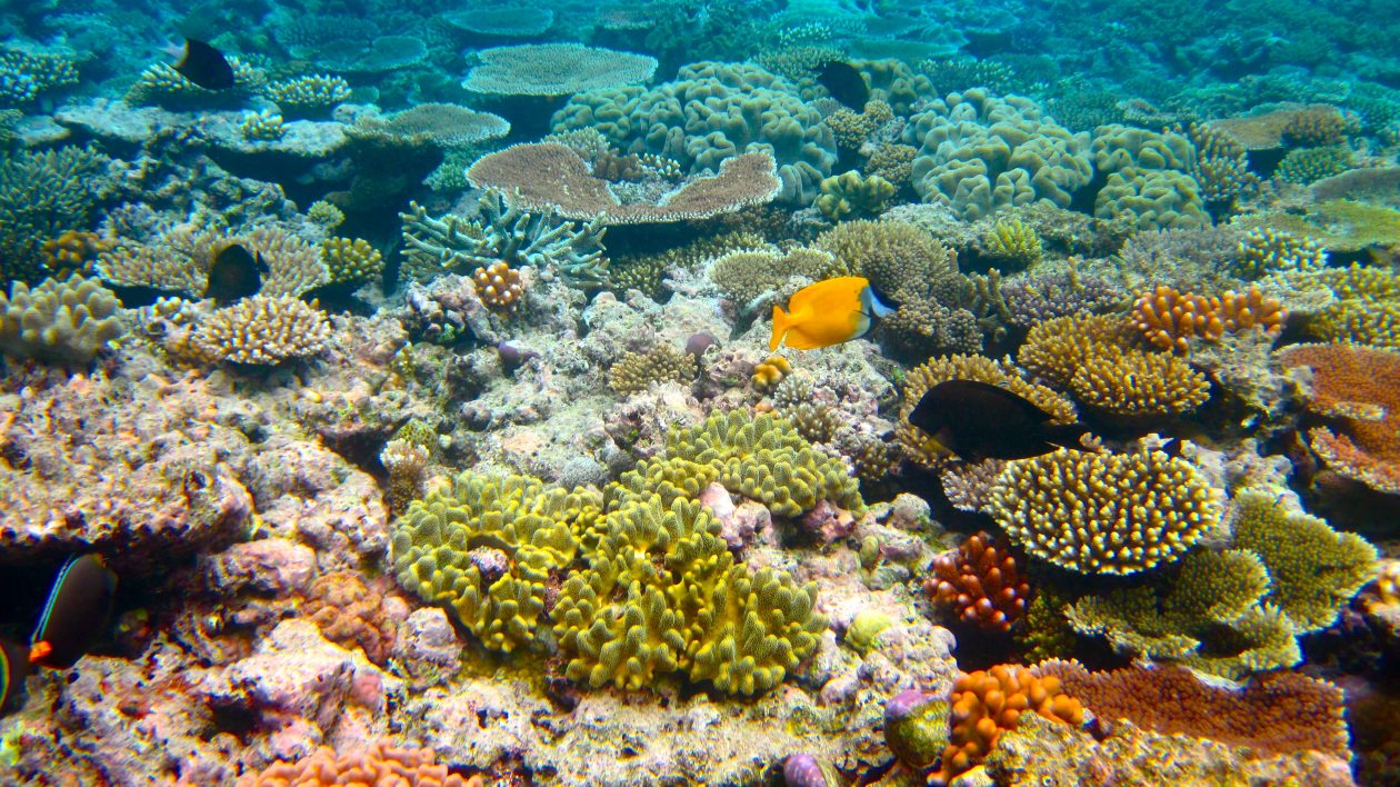
Not all corals are affected equally. “The very corals that give the GBR its great resilience, the Acropora corals, are very sensitive to runoff,” says Wolff.
He explains that the beautiful corals in the Acropora genus — sometimes called elkhorn and staghorn corals — are all fast-growing species that help kick-start recovery after a disturbance like cyclones, bleaching, or COTS outbreaks. Acropora typically suffer the most during these disturbances, yet as long as they can reproduce they bounce back quickly.
But on a polluted reef, sediments stick to coral egg bundles and hinder fertilization. Any larvae that do develop have to compete with increased algae for bare surfaces to attach to, while sediments and phytoplankton block the light they need to photosynthesize and grow.
By hindering the Acropora’s ability to recolonize, sediment pollution makes the entire reef more vulnerable to other threats.
Linking Rivers to Reefs
Given its potential for harm, river pollution is high on the list for conservationists and managers trying to protect the GBR. But until recently, scientists didn’t have a good understanding of how individual rivers connect to individual reefs.
“A total of 34 rivers feed into the GBR system, 17 of which are considered major inputs,” says Wolff. “When these rivers dump onto the reef, where do they flow? And which reefs do they impact?” Without that information, managers have no way to prioritize which river areas to work in, in the hope of improving water quality on the greatest number of reefs.
Previous research used satellite imagery of river plumes — large flows of discolored water pouring into the ocean from each river mouth — to try and connect the dots. But Wolff explains that such imagery isn’t always reliable, because in certain areas multiple plumes run together.
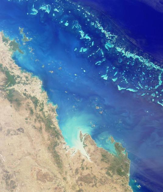
Instead, Wolff and his colleagues used a computer model and digital tracers to map what happens to the outflow from 16 of the GBR’s major rivers. “It’s like a virtual dye that we release in different rivers in the computer model, and we can follow its fate throughout the GBR,” he says. They ran this model using real rainfall data from four previous wet seasons between 2009 and 2013.
Their results show that just a handful of rivers impact a significant portion of the reef. In the 2010-2011 wet season, the plumes from just four rivers — the Burdekin, Tully, Daintree, and Fitzroy — touched 1,020 individual reefs covering more than 5,600 square kilometers of reef area.
The results also allow scientists to pinpoint reefs that are exposed to high levels of pollutants from just one or two rivers, which could help prioritize conservation efforts. “It’s hard to inspire landowners to take action if you vaguely say they’re impacting the reef,” says Wolff. “But now we can point to the exact reefs they are impacting on a map.”
Solving the Pollution Problem
The solution to reducing nutrient and sediment pollution on the reef lies in changing regulations for land-clearing and agriculture, both thorny political issues.
The Australian Government’s Reef 2050 plan outlines targets for an 80 percent reduction in river nutrient loads by 2025. But those targets are based on a 2009 baseline of nutrient loads, which is still up to nine times more nutrients than before European settlement.
Previous government programs tried to subsidize a switch to less nutrient-intensive practices, yet they proved ineffective. “The funding was handed out evenly across the catchment, spreading it vegemite-thin,” says Hugh Possingham, Chief Scientist at The Nature Conservancy. “The problem is that just a tiny fraction of the landscape causes most of the problems.” Possingham advocates for a more targeted approach, where funding is distributed to areas contributing the most pollution.
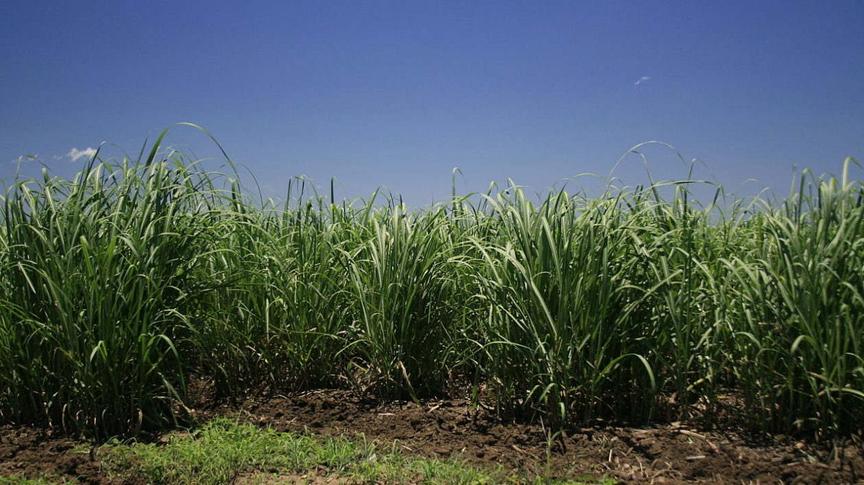
Yet incentive programs alone will not be enough to save the reef, unless they are combined with clearing regulations. An estimated 37 percent of all land cleared in Queensland since 2012 is located in the GBR catchment area.
“Land clearing rules… are probably the cheapest way to actually make headway with water quality issues,” says Fabricius. “Individual remedies are just band-aids if the regulation is not in place to prevent further land clearing.”
The Queensland State government recently passed stronger clearing regulations, which will help limit future clearing. But without restoration, erosion will continue on already-cleared land.
Until then, the reef remains at risk.


OOF
This is a very sobering article, but very well researched and written. It’s amazing at how far the science has come that we can pinpoint the largest contributors to the pollution. That should give us some hope that we can help to turn the tide.
So goes the GBR so goes the world.
Great article.