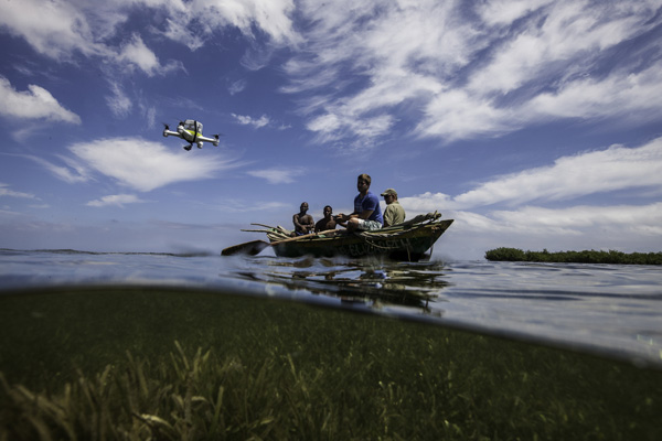
The small, agile quadcopter touched down and landed softly on the water.
It took off again, circled 250 feet above us and smoothly drifted through the air along a pre-programmed path.
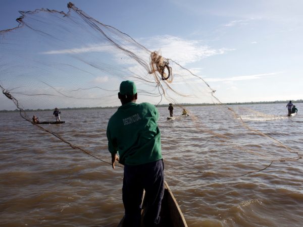
The local Haitian fishers looked up and stared in awe at this strange new flying machine. They are not alone in their fascination with drones, which have recently gained press attention for uses ranging from controversial military operations to Amazon home delivery.
So far, uses in conservation have mainly been focused on monitoring poaching and counting wildlife.
As a tech mapping nerd, I have been following the technology, and have been wanting to build a drone and use it to map marine habitats for The Nature Conservancy’s Caribbean program.
My opportunity arrived when Jordan Mitchell, one of my students, showed an uncanny skill for drone building and operations in a remote sensing class I was teaching.
Impressed by his knowledge, I challenged him to design a drone on a $2000 budget.
However, there was a catch: this drone had to be amphibious—able to land and take off from water and survey habitats both above and below water.
In less than a month, Jordan had the drone designed, built, and tested.
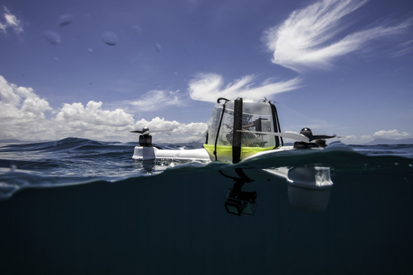
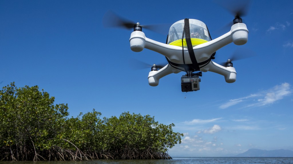
Weighing in at just under 5 pounds, “Henri” (named in honor of the king of Northern Haiti from the early nineteen century) has a tough, floatable KYDEX® frame equipped with a high-def GoPro camera, an GPS enabled-autopilot chip, and other navigation electronics tucked neatly inside an upside-down Tupperware container mounted on top that serves as a perfect waterproof housing.
Henri can be guided manually using remote control or via autonomous mode with a pre-programmed flight path.
Over a few days in May, our team collected several hours of videos using Henri along the coast of a newly declared protected area in northern Haiti.
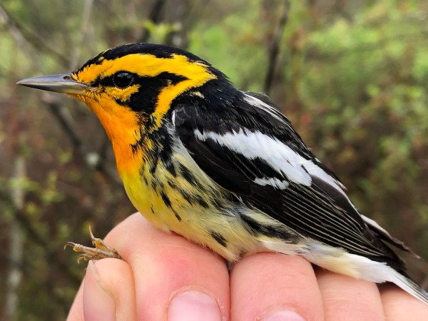
These videos are being used to document ecological conditions and validate habitat maps derived from satellite imagery. Henri gives us a different perspective on the coastal environment from what we normally see from satellite images or boat surveys. The video footage gave us a sense of the ocean dynamics around the reef and allowed us to identify species of interest such green turtles and rare corals, such as Acropora palmata.
Coincidentally, around the same time along the northern coast of Haiti, underwater explorers reported the discovery of what may be the wreckage of Christopher Columbus’s boat the Santa Maria, which sank in a storm there more than 500 years ago.
As the field team packed up Henri and returned home, we had all gained a new appreciation for drone technology and what it offers the conservation world – a promising future in providing a new and exciting lens to visualize our dynamic world.
This new window will provide enhanced information to protected area managers on a more regular basis to allow them to monitor impacts, assess the health of habitats and evaluate the success of management strategies.
As for Jordan, he ended up getting an A in the class.
Hi TNC. This mapping device “Henri” is absolutely awesome. I come from Papua New Guinea. I was wondering if your TNC office in my country would have this coastal mapping drone to do mapping for LMMA sites in East New Britain, Manus and Milne Bay Provinces?
Really cool, Congratulations!
Amazing project! Great work guys
Thanks for your comments and support – While we don’t yet have a published article to share, I’d be happy to send a PDF that describes the system in more detail. Please send an email to sschill at tnc dot org.
Hi, wonderful work, congratulations! I’d like to explore the opportunity to replicate Henri for the western indian ocean coastal zones. Could you contact me directly on my email address please?
Is there any pdf or article you guys have published? 😀 Very interested in applying these technologies into the gulf of california