A team of 91 international scientists and conservationists is working to create the first-ever global atlas of ungulate (hooved mammal) migrations. New detailed maps of the seasonal movements of ungulate herds worldwide would help governments, Indigenous people and local communities, planners, and wildlife managers identify current and future threats to migrations, and advance conservation measures to sustain them in the face of climate change and an expanding human footprint.
The Gist
Around the world, ungulate migrations are disappearing at an alarming rate. Efforts by wildlife managers and conservationists are thwarted by a singular challenge: Most ungulate migrations have never been mapped in sufficient detail to guide effective conservation.
“A global migration atlas is urgently needed because there has never been a worldwide inventory of these phenomenal seasonal movements,” said lead author Matthew Kauffman, a wildlife biologist with the U.S. Geological Survey. “As landscapes become more difficult to traverse, the migration maps can help conservationists pinpoint threats, identify stakeholders, and work together to find solutions.”
To organize and support the mapping effort, the team has partnered with the Convention on the Conservation of Migratory Species of Wild Animals (CMS), a UN treaty, to create the Global Initiative for Ungulate Migration.
A combination of animal tracking datasets, historical records, and local and Indigenous knowledge will form the basis for a global atlas of migrations, designed to support conservation action and policy at local, national, and international levels.
“The challenge right now is there are a lot of experts across the globe working on ungulate conservation, but the data is scattered,” said TNC scientist Anne Trainor. “When that data is consolidated into the global atlas, we’ll also be able to identify migratory hotspots that aren’t necessarily well known and identify the data gaps for migrations that may not have been mapped.”
The Big Picture
Migratory ungulates are an essential part of natural ecosystems and provide much of the prey for the world’s carnivores. These often-lengthy migrations also contribute to local and regional economies through harvest and tourism and are woven into the culture of numerous communities.
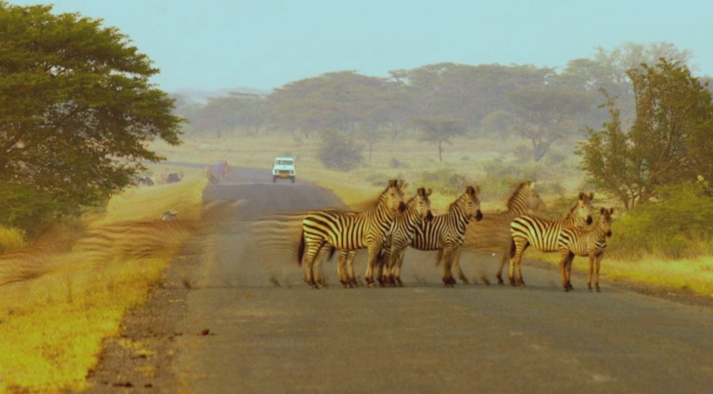
Unfortunately, many ungulate migrations are in steep decline due to climate change and other human disturbances like roads, fences, and other types of development. For example, the current migrations of Mongolian Gazelles, where individuals roam over hundreds of kilometers, are sharply constrained by border fences and new railroads. Researchers in Kenya’s Kajiado County have documented the near collapse of the migrations of Wildebeest, zebra, and Thomson’s Gazelle due to unplanned roads, fences and other infrastructure.
The Takeaway
The very few migration maps assembled today already underscore that protected areas are far too small and scattered to protect the wide-ranging ungulate movements. At the same time, existing maps are already helping highlight how numerous landowners and communities have successfully stewarded the working landscapes that animals traverse. Maps that display migration data together with the human connections and livelihoods associated with these same landscapes can help advance sustainable conservation.
The launching of the Global Initiative for Ungulate Migration is necessary and timely given the increasing international focus on protecting biodiversity. A new UN global strategy on biodiversity known as the Post-2020 Global Biodiversity Framework is expected to be agreed to this year. CMS Parties have singled out the importance of ecological connectivity, including animal migrations, as a key priority for the new framework.


Join the Discussion