By Thomas Minney, Director, The Nature Conservancy’s Central Appalachians Program
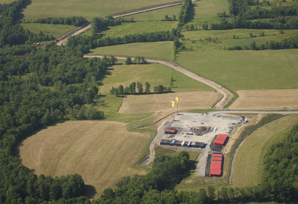
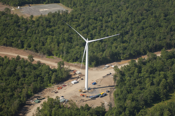
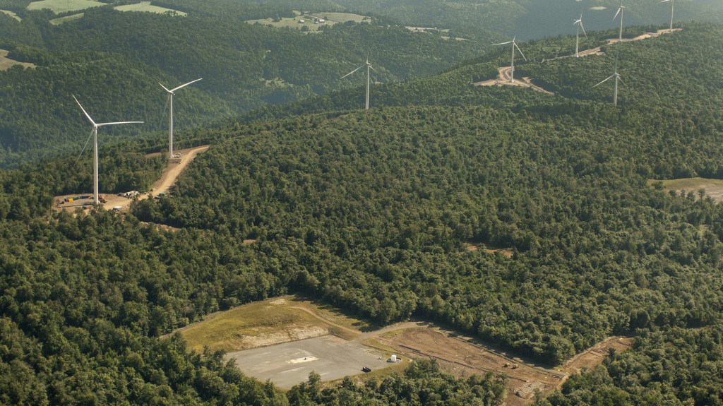
A traveler doesn’t need to spend much time on the winding highways that cross the Appalachian Mountains to know that this part of the country is in the middle of an energy revolution. Towering wind turbines cleave the air over mountain ridges. The derricks of shale gas wells stand brightly lit against the night sky. Coal trucks rumble over mountain roads.
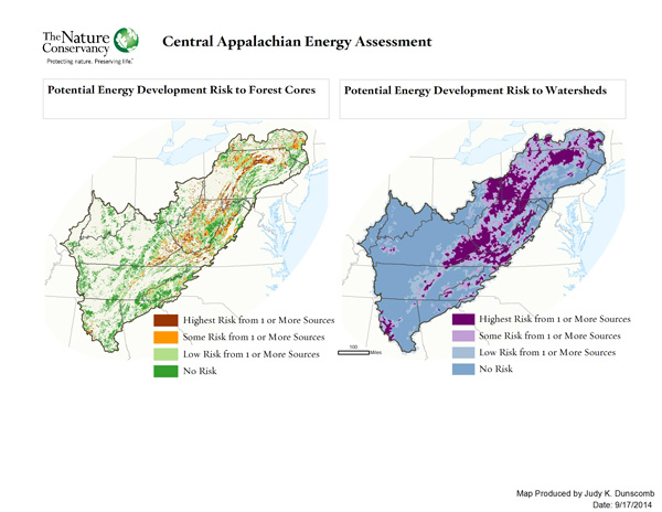
A new study released today by The Nature Conservancy and the Appalachian Landscape Conservation Cooperative presents the first comprehensive picture of what future energy development could look like in the Appalachians. Among the most important findings:
*Nearly 7.6 million acres (an area larger than the state of Massachusetts) of new energy-related development may expand across the Appalachian region by 2035.
*An estimated 5.3 million acres (roughly the size of New Jersey) of this new energy-related development is most likely to occur in forested areas.
*More than 150 watersheds are at high potential risk for development – watersheds that produce clean water for major cities and communities.
Coauthored by Nature Conservancy scientists Judy Dunscomb, Jeffrey Evans, and Joseph Kiesecker, the study uses data on energy resources from state and federal agencies to model energy development potential for wind, shale gas, and coal in a 15-state region.
It incorporates input provided by the energy industry, regulators, and other researchers. A web-based mapping tool shows where areas with a potentially high likelihood of energy development may overlap with important natural resources and associated benefits, such as municipal drinking water supplies.
What’s happening in the Appalachians isn’t isolated: booming development has become familiar in many parts of the world as global energy demand has increased by more than 50 percent in the last half-century.
This demand is expected to continue its steep upward trajectory, and with this growth we’ll see energy’s influence on the landscape grow – with a footprint covering nearly 50 million acres in the U.S. alone by 2035.
Of course, large-scale energy development has been familiar in the Appalachians since at least the mid-1800s, but several factors are intensifying the demands on this region’s resources: new technologies have opened previously untapped supplies of natural gas, the desire for renewable energy is driving a wind energy boom, and concerns over future energy security is encouraging the full development of our domestic energy resources.
How we choose to meet these demands will have significant implications both for nature and human well-being.
The Appalachian region is a global hotspot for plant and animal diversity, with some of the most diverse, intact, and connected temperate forests and freshwater streams in the world.
Appalachian rivers are intricately linked to the drinking water of millions of people in the Mid-Atlantic, Midwest, and Eastern United States. And the region is an important rest and recreation area for people in the region and beyond.
Despite the critical importance of these natural resources, we have not, as a society, considered the cumulative impacts of current and future energy development to forests, streams, and other habitats.
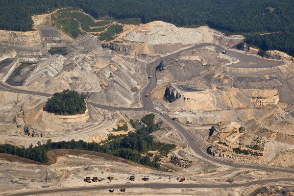
Each wind farm, gas well, or coal mine is considered individually, one at a time. Neither regulating agencies’ nor industry’s current practice looks across a region to consider the big picture.
This study provides us that big picture.
Compared to the study area the estimated energy development acreage may not seem huge, but this future development is not likely to be evenly distributed, but instead will be highly concentrated in mountainous portions of Pennsylvania, West Virginia, and Kentucky.
Neither do these energy sources overlap. Instead, potential wind development in the Appalachians is most likely along forested ridgelines of the Allegheny Front and Blue Ridge mountains. And while coal is most abundant in the Cumberland Plateau, most of the shale gas development is occurring farther north in the Allegheny Plateau.
What can we do with this information?
Our hope is that this report will stimulate new discussions among conservation organizations, policy makers, regulators, industry, and the public on how to protect essential natural resources while realizing the benefits of increased domestic energy production.
This report complements other tools that can help influence how development unfolds. For example, Tamara Gagnolet of The Nature Conservancy’s Central Appalachians Program has worked with research organizations and gas companies to create a unique mapping tool that can help reduce overall environmental impacts related to the placement of well pads, roads, and pipelines on the landscape. The tool will be available to guide gas operators, regulators, and land managers toward more environmentally sensitive decisions about infrastructure placement.
We’re also developing a suite of science-based recommended conservation practices to guide landscape-scale planning, reduce noise and light pollution, improve stream crossings, and encourage less harmful road and pipeline development.
This new Appalachian-wide study, unprecedented in its scope and scale, shows where likely future energy development overlaps with important natural resources.
By pinpointing these overlaps, we hope to catalyze productive discussions about how we meet our energy needs while maintaining biological diversity and the ecological values that this diversity provides to people.
We want to bring land management agencies, energy companies, and policymakers together to examine and minimize impacts on natural resources over wide geographical areas in the long-term with the goal of avoiding impacts wherever feasible and minimizing impacts that cannot be avoided.
We don’t have to wait until there is a crisis. We can do this better. We have the science and the technologies available to figure out solutions that will sustain both people and nature in the Appalachians for generations to come.


It’s good to see an article that doesn’t try to minimize the ugly clearcuts, roads and looming presence of wind turbines in the context of environmental desecration.
Too many fans of wind power refuse to see those inefficient, fossil-fuel-dependent giants as anything but “beautiful,” which is a bad taste many of us will never acquire.
http://cutt.us/blightfornaught
Wind turbines are far more visible that other forms of energy development now. They are falsely claimed to be “green” while industrializing huge sections of scenery, which is why so many people can’t stomach them. Noise, red light and bird & bat kills add to their already high impact. Pro wind power arguments usually change the subject to older blight while minimizing known problems with turbines, or dismissing complaints as NIMBY lies.
You can restore much of the land when oil wells play out, and the same applies to coal mines, though mountain heights are reduced. Open mines are nasty looking but at least they aren’t spiked with white towers that are visible for dozens of miles. Some mountaintops are removed permanently for wind turbines but you don’t see their advocates howling about that damage. Hypocrisy is pervasive in the wind industry.
Wind turbines are full of hypocrisy, being the tallest, most easily visible, kinetic energy source. They add flashing red lights all night to top it off. Just because they don’t actively burn oil (that is, after manufacture and installation) doesn’t make them green. The wind industry portrays them as somehow quaint sculptures, often shown with foreground objects exaggerated, but they are colossal and dominate most rural landscapes. Energy sprawl is really quite depressing for those of us who thought protecting the environment included the total environment, not just fossil fuel reduction. Are we to save the planet by turning it into a huge industrial park? Much enjoyment of life will be lost if such huge structures keep multiplying.
San Diego is part of the Migratory Route for birds–yet east of the city are hundreds of these “green” windmills, killing countless birds! It’s unconscionable, unethical, unreasonable and wrong. But that area of the county is less populated, thus easier to run rampant over our precious land.
Wind development also uses a lot of land which some people forget about even though they believe it’s so green. Extracting oil, natural gas and most especially coal will always have a negative impact although improvements can still be made. Reclaiming and reforesting areas that were once used to extract oil and natural gas are beneficial.
Open pit coal mining that removes mountain tops needs to be made illegal in every state. We like to criticize other countries for their environmental practices yet we still allow the complete destruction of mountains and watersheds!
The fracking has to be stopped – everywhere. But a new wind farm being constructed next to a fracking well -with bird/bat killing turbine blades? Please!! – Why is it Big Wind doesn’t care about birds? Simple new bladeless technology would make the turbines acceptable and extremely valuable! But no, Big Wind, has to slaughter birds – millions each year! Nature Conservancy – you are guilty of promoting Big Wind’s bad practices and bird-killing. With all your good work, get on the right side of nature, please!
I agree – We call wind turbines “RAPTOR CUISINART” here in California; the eagles and hawks are sliced in half or in pieces – thousands of them. Wind farms and those spinning blades are KILLERS – we need the new bladeless technologies to replace these monsters.
Bladeless wind turbines (still just a concept) would remain ugly, and probably generate even less (intermittent) power. The whole notion of large machines in the countryside as “green” has always been farcical.
What the world really needs is more personal restraint, conservation and birth control to stabilize future demand. But that’s too logical for a growth-maddened society.
http://cutt.us/blightfornaught
Wind Turbines with blades kill millions of birds each year – and are recklessly cited to maximize air/wind current flow to generate energy – in the same places here birds fly! The wind turbines in this article should be replaced with bladeless turbines that last longer, have a lower repair and failure rate, do not make noise and most importantly DO NOT KILL BIRDS AND BATS. BIG WIND: ARE YOU LISTENING? Replace those ugly, big, bird-killers and WE WILL SUPPORT YOU!