My friend and I drove along a road paralleling a trout stream, enjoying the site of riffles and clear pools. Slowly, almost imperceptibly at first, the stream began to slow, and then gave way to a flat expanse of still water. A reservoir, created by a dam.
“Why can’t we just get rid of these dams?” my friend asked.
I write and speak about fishing and freshwater conservation, and it’s a question I hear a lot. For many conservationists, dams are one of the biggest detriments to all we hold dear. Certain high-profile dam projects rank among the environmental movement’s most iconic battles.
And yet, here’s the thing. Dams undeniably provide us with many benefits: hydropower, flood control, irrigation and more. And few realize the scope of dams: There are at least 90,000 dams of head-height or greater and more than two million smaller dams and stream barriers in the United States.
Dams are not going away.
But here’s another thing. Many dams can be managed in better ways that offer benefits for biodiversity and people. Some dams have become obsolete. Others have not had their operations modernized, and new management plans can improve the social, economic and environmental benefits they provide.
In 2002, The Nature Conservancy and the U.S. Army Corps of Engineers—the largest water manager in the nation—launched a collaborative effort to find more sustainable ways to manage river infrastructure in order to maximize benefits for people and nature. The Sustainable Rivers Program focuses on determining unique flow requirements for rivers and then creating operating plans for dams that achieve environmental flows.
The pilot program included 16 rivers in 15 states by 2019. A significant boost to Federal funding this year plus support from a key donor, Tom’s of Maine, has increased the program to almost 30 rivers in 30 states.
What do sustainable flows look like in practice? How are they achieved? Let’s look at three different rivers that show the breadth and depth of the Sustainable Rivers Program.
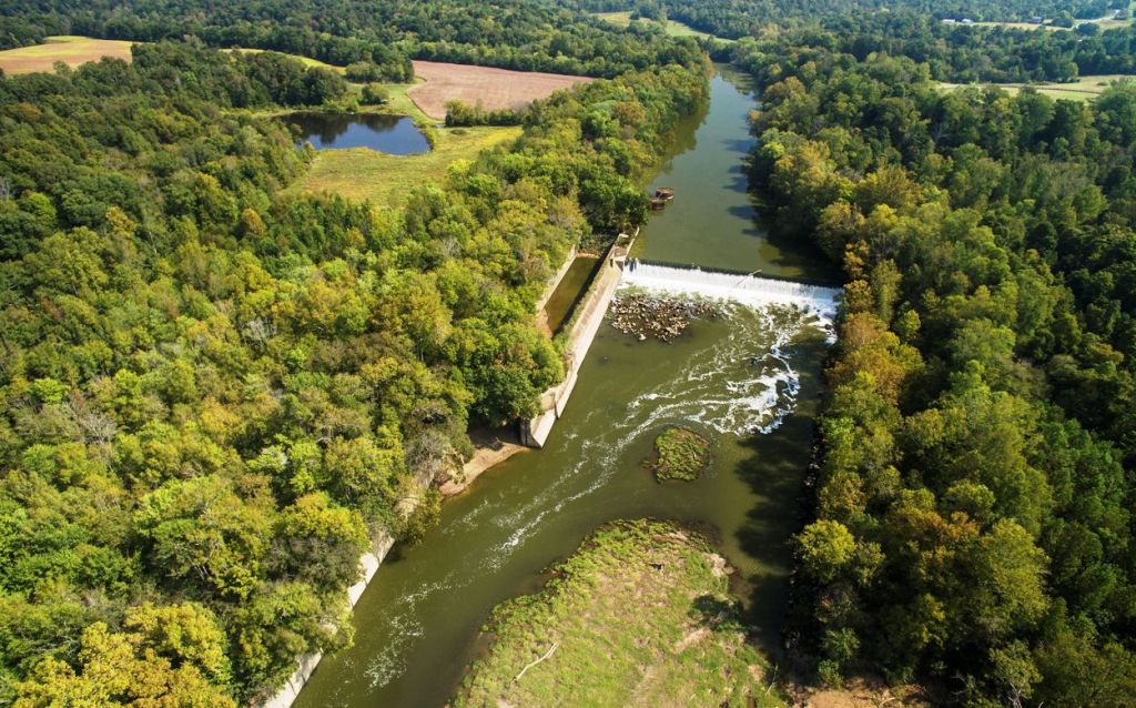
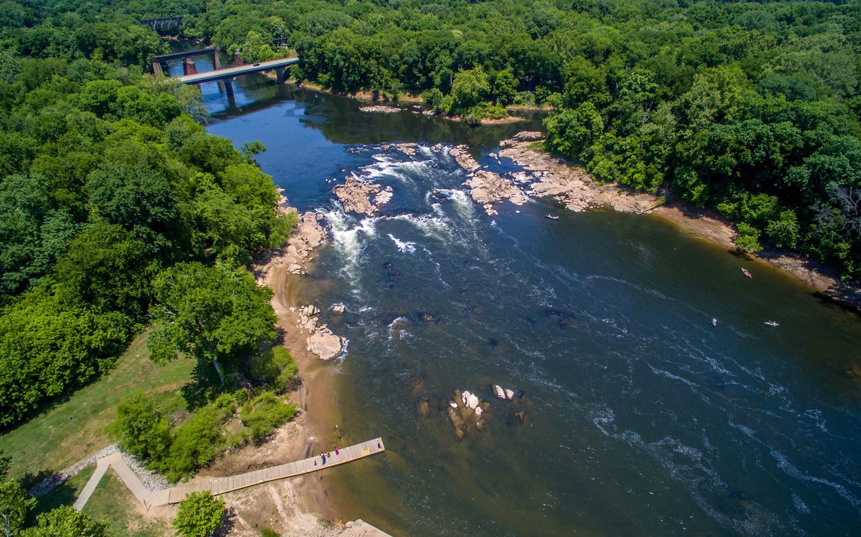
Green River, Kentucky
Mammoth Cave National Park is well known for its underground wonders. It’s the longest known cave system in the world, and is recognized as a World Heritage site. Many of the visitors, awed by the expansive cave ceilings, have no idea that above ground there is a natural heritage that’s equally astounding.
The Green River, flowing through the national park, is one of the most biodiverse rivers in North America. It’s home to 150 fish species (including eight found nowhere else) and is particularly important for freshwater mussels.
“Historically, the Green was the ‘Goldilocks’ of rivers,” says Danna Baxley, director of conservation for The Nature Conservancy in Kentucky. “The conditions were just right for a wide variety of species.”
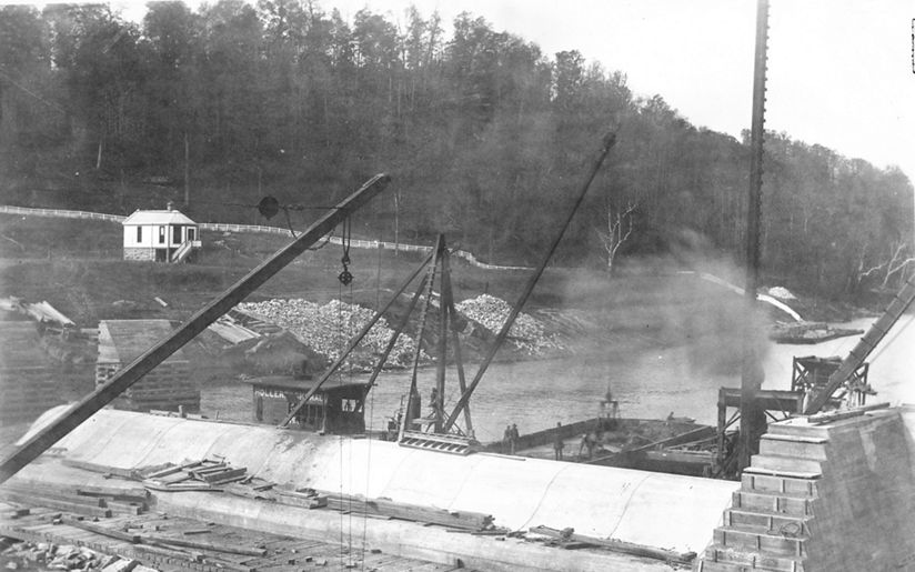
That changed with locks and dams built on the river beginning in the early 1900s. The dams slowed the river in areas, eliminating key habitat for fish and mussel spawning. The dams even impacted Mammoth Cave, as the water backed up into the karst, flooding some areas underground.
“The Green River was one of the earliest conservation targets for the Conservancy’s work in Kentucky,” says Baxley. “And as we looked into the best ways to protect and restore it, we saw an opportunity to better mimic the river’s natural flows.”
That led to one of the first ecological flows initiatives the Conservancy undertook, working with the Corps of Engineers and a long list of other partners. The effort helped launch the Sustainable Rivers Program.
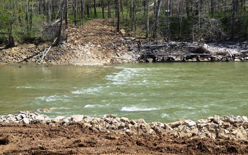
Examination of the locks and dams on the Green revealed what is so often the case on other rivers across the country: the infrastructure was outdated, showing signs of decline and posing public safety hazards. A plan was launched to breach or remove multiple dams, restoring much of the Green River. The values of a free-flowing river is further supported by the environmental flows managed at the dams that remain.
In 2016, a dam failed on its own, creating an even more significant navigation hazard. That hastened the effort to remove it completely. The Green, as the Conservancy put it, had “reclaimed its heartbeat.”
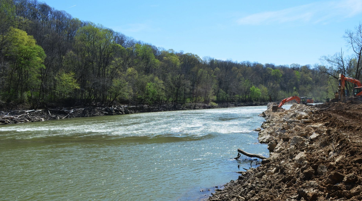
Two more dams are now scheduled for removal. “A carefully orchestrated, well-planned removal is so much better than removing a dam after it fails,” says Baxley.
Such removal depends on the best-available science to determine the best way to draw down water behind the dam, and to account for human needs – such as community water supply – as well. But the benefits of the removal are quickly apparent to ecologists as fish and mussels reclaim habitat. And they’re equally apparent to local communities.
“Towns near Mammoth Cave can now benefit from renting canoes and kayaks to tourists,” says Baxley. “Previously, many of these towns were cut off, as canoeists couldn’t negotiate the river safely. There are now all these new routes.”
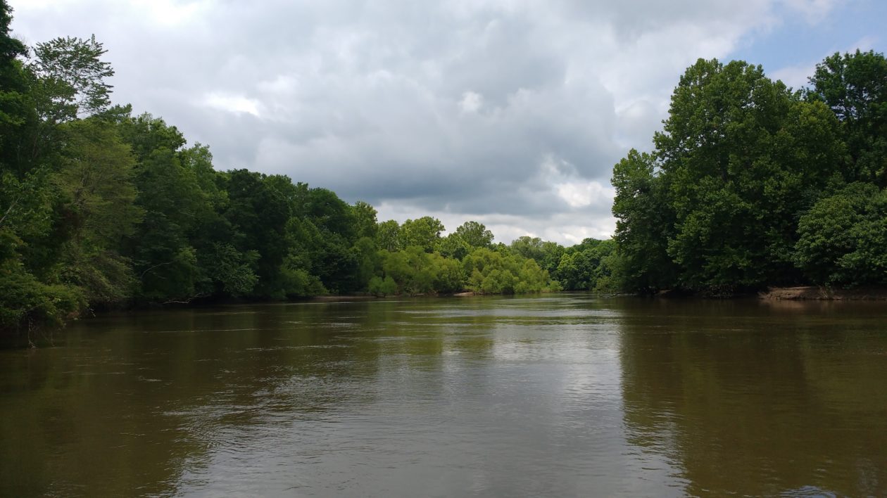
Roanoke River, North Carolina
The Roanoke River Basin stretches 400 miles from the Blue Ridge Mountains to the Albemarle Sound. It has the reputation for being a wild, natural landscape, notable for the undeveloped bottomland hardwood forests and excellent fish populations. And that’s true, but altered environmental flows were negatively impacting the landscape.
“Even though this area is wild and undeveloped, we were seeing pro-longed growing season floods that hurt the floodplain vegetation, eroded river banks, and caused low dissolved oxygen levels that resulted in fish kills,” says Julie DeMeester, water program director for The Nature Conservancy in North Carolina.
That’s because of three dams located on the river, the biggest one which was operated by the Corps of Engineers. The dams blocked migratory fish passage and also impacted flows and water temperature.
The Nature Conservancy had invested in this landscape since the 1980s, protecting 95,000 acres of land encompassing nearly 570 miles of creeks and waterways. But that protection could only go so far.
“Those dams provided many benefits,” DeMeester says. “But starting in the 90s the Conservancy started to ask if there were ways to operate the dams that are better for conservation.”
About the same time, efforts were underway with environmental flows on the Green River. When the Sustainable Rivers Program formalized in 2002, the Roanoke was automatically enlisted in the program because of the on-going work between the Conservancy and the Corps of Engineers in the basin. Along with other on-going efforts, this provided additional momentum to analyze the Corps water control manual and find dam releases that more closely mimicked natural flows.
After decades of work and studies, the Corps adopted Quasi-Run-of-River that enables bigger dam releases but of shorter duration. This more closely resembles natural storm patterns and what nature is used to experiencing. The more natural pulsing improves the health of the floodplain, reduces the likelihood of low dissolved oxygen, and creates more favorable conditions for migratory fish species like alewives and blueback herring.
Instituting environmental flows often offers rapid benefits for fish and other wildlife. But this isn’t a case where you institute new management and all you have to do is sit back and watch the results. “There is still a lot of research happening to improve conditions,” says DeMeester. “Since implementing QRR we have had the wettest years on record and there is a lot to learn.”
For instance, during pulses native fish often move into floodplain forests to spawn or for refuge. Road crossings and small barriers, however, may prevent them from getting back to the river. “The fish were getting into the floodplains, but were trapped and dying once that habitat started drying,” says DeMeester. “Landowners were also having water trapped on their land. We are now working with landowners and others to remove barriers, so fish can get back out and people can access their property.”
Remote sensing is providing critical information about vegetation and water on the floodplain. Climate models are in the works to provide information that will enable the best management with changing weather patterns. Researchers are now using eDNA to investigate how flows affect migratory fish including alewives and blueback herring.
“Changing river flows is a balancing act,” says DeMeester. “How do we think about environmental flows for an entire river? It’s a complex task. We are fortunate to work with our partners and to utilize research to inform decisions that best benefit the watershed and the people who live there.”
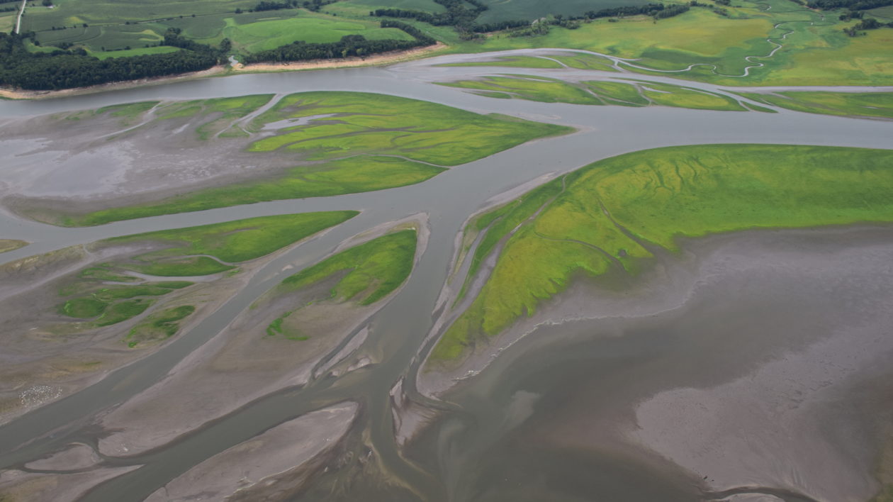
Des Moines River, Iowa
Fish were floating on the surface, eyes bulging. The fish kills below the Red Rock Dam on the Des Moines River were initially a puzzle. Familiar reasons for such kills – pollution, disease, water temperatures – were ruled out. Research revealed that the culprit was changes in pressure induced by rapid changes in dam discharges.
“It was causing fish to develop similar issues to a diver developing the bends from coming to the surface too quickly,” says Hugh Howe, natural resource specialist for the U.S. Army Corps of Engineers.
This was just one issue that altering dam discharges at certain times of the year could address. The Red Rock and Saylorville dams on the Des Moines River were established for flood control. And by nearly any measure, they’ve performed that task exceedingly well. “The two dams have prevented an estimated two billion dollars in flood damage since their inception,” says Howe. “Before these dams were constructed, flooding was a regular occurrence. They have paid for themselves many times over.”
Howe notes that the Corps only has to manage for floods approximately 10 to 15 percent of the year. “The rest of the year, there are opportunities to manage for other purposes,” says Howe. “We are limited by our water control plan, but we still have a lot of flexibility.”
In partnership with The Nature Conservancy, the Corps worked with stakeholders to determine specific ecological needs. Environmental flows were established to sustain healthy ecosystems and provide community benefits.
One of the primary issues facing the Des Moines River is water quality, and managing water levels in the reservoirs can aid in nitrate reduction. “These are huge reservoirs that can be managed as nutrient removal wetlands,” says Howe. “We just need to get the science right.”
And environmental flows provide a long list of other benefits. “We depend on the ecological health of our lakes and rivers,” says Howe. “Environmental flows allow us the opportunity to benefit a variety of species. We can identify when flow pulses can be implemented without impinging upon flood control. We can adjust lake levels to attract migrating shorebirds and make vegetation more desirable for waterfowl. We can design flow pulses to benefit fish reproduction and foraging.”
Since altering flows, the Corps has not observed any fish kills from gas bubble trauma, and investigating how to avoid rapid water flow changes that impact aquatic organisms is a recognized priority. But the project also takes an even larger view: the Corps and Conservancy recognize that healthy rivers depend on healthy watersheds. And that means addressing conditions far upstream of the dams.
“There’s a lot of momentum,” says Howe. “I’m excited to see the outcomes. Since I became involved with the Sustainable Rivers Program in 2015, there’s been a snowball effect. The potential outcomes excite people. They see possibilities.”


Good article highlighting how river restoration with water flow managers can work together to benefit people and wildlife.