Ocean conservation has always been a challenge. The ocean is a largely unknown, highly dynamic, and often distant, submerged environment. For these reasons, most marine science and resource management is typically conducted from the shore or in small, defined areas like protected waters.
All the more complicated is studying migratory marine wildlife. They are rarely seen from above and require complex, expensive technology to access them beneath the surface. Adding to the challenge, these animals are constantly on the move across large swaths of ocean.
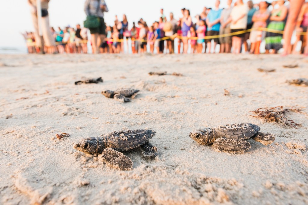
Despite the challenges, humans are captivated by marine migrations—when sea turtles return home to nest on same beach where they hatched decades earlier, when pods of whales can be seen from our shorelines, or when the whooping cranes begin to appear, signaling a change in seasons.
Still, the vast majority of journeys conducted by all marine species occur either so far beneath the surface or high up in the air, that they are largely secretive to most of us.
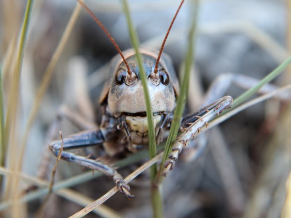
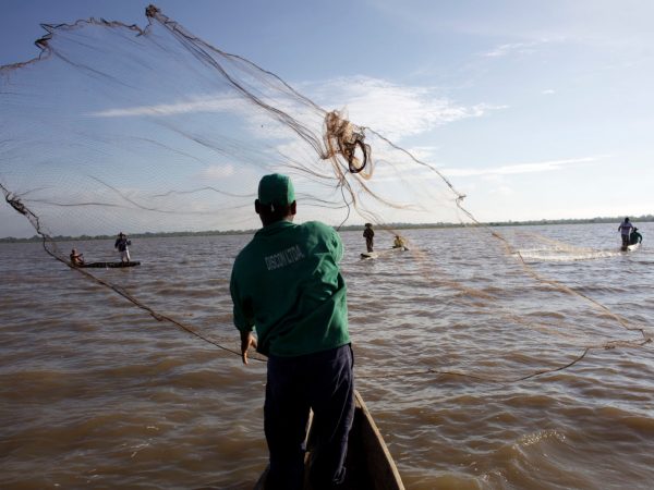
The Gulf of Mexico is home to over 15,000 species, including fish, endangered sea turtles, marine mammals, and coastal and sea birds. Many of these species migrate through the Gulf’s waters and along coasts to accomplish different life stages such as feeding, spawning, or nesting. We need to understand these migrations for a variety of reasons that affect human economic and social activity.
Migratory species often travel in large groups. This amplifies the impacts of threats or migratory barriers to their populations as well as impacts of their losses on globally important industries like fisheries and tourism. We see this during the massive harvests of tuna, billfish, mackerel, and shark during their seasonal runs, when whales and dolphins collide with vessels, and when exhausted birds fall from the sky, colliding with buildings, antennas, or windmills.
Unsustainable fishing practices and poorly planned offshore and coastal developments can have significant impacts on migratory marine life. These issues often cascade down, affecting the health of the ecosystem and the industries it supports.
Unlocking the mystery of the Gulf
In 2015, the Conservancy began looking at opportunities to conserve migratory marine wildlife in the Gulf of Mexico. An initial step was the publication of a report describing the migratory pathways for several fish, sea turtles, marine mammals, and birds (Brenner et al. 2016).
The species included in this assessment were either endangered or threatened, commercially or recreationally important, or crucial for maintaining ecosystem health. This report synthesized data from hundreds of studies and satellite-tracked species, and it gave us our first real glimpse at what peeling back the surface of the Gulf might look like. This research helped the Conservancy identify the most transited areas of the Gulf, its blueways.
A framework for migratory species conservation
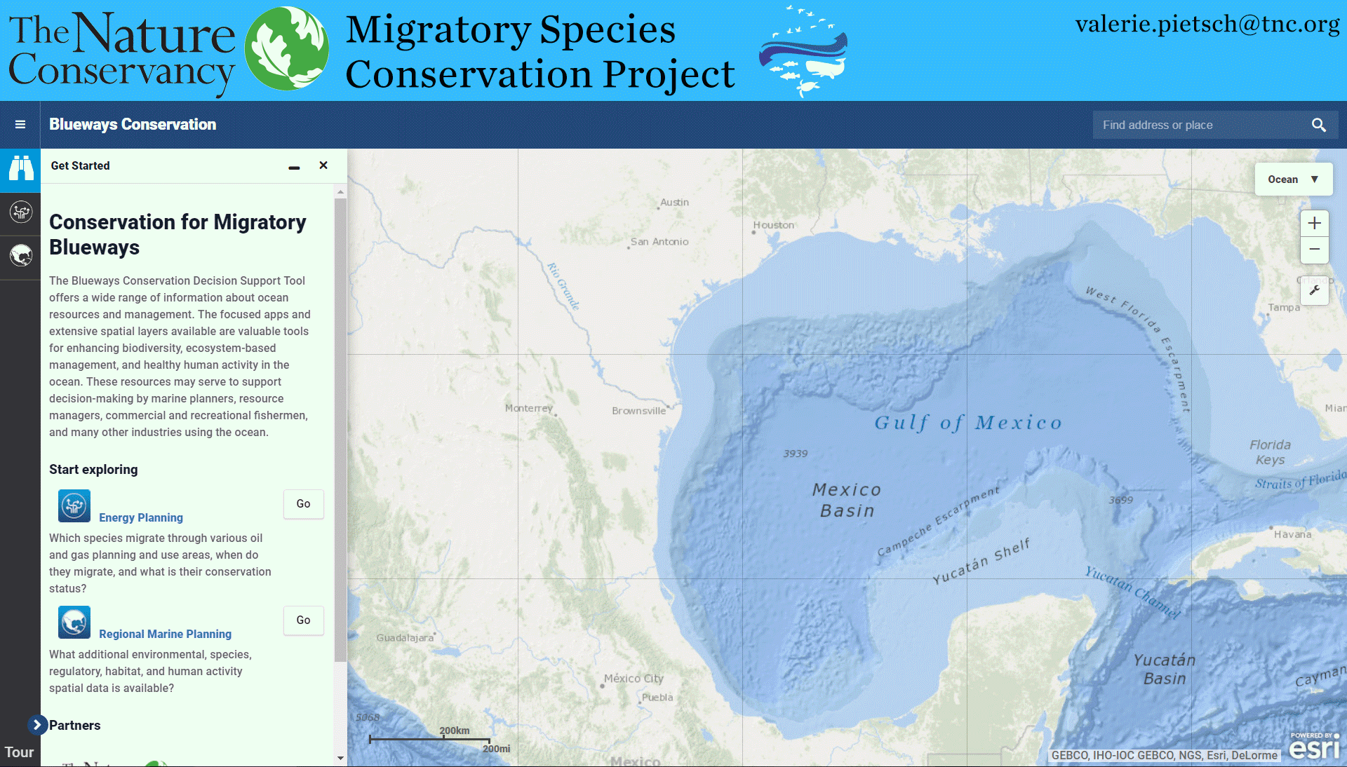
All of this information, along with a comprehensive vision for conserving the incredible migratory species in the Gulf, is now available on the newly launched Migratory Blueways website and corresponding Blueways Conservation decision support tool.
The Migratory Blueways website presents complex information in the accessible format of marine planning case studies, live animal tracking tools, and visually-informative infographics and maps. It also provides a platform for increased data-sharing between researchers, resource managers, energy planners, industry managers, and conservationists. Further, the Blueways Conservation mapping portal provides them with one-stop, interactive access to a wealth of resources: migratory, environmental, regulatory, and industry-specific spatial data; species information and conservation techniques; and seasonal migration pattern research.
This project was supported by Shell as part of its broader collaboration with the Conservancy, focused on identifying innovative ways to protect the environment and bring conservation knowledge to industry and public-sector partners. Migratory pathway development and the publication of our first report was made possible by support from the Lyda Hill Foundation.
Making headway on marine wildlife conservation could take decades in the Gulf and making this data available in an interactive and sector-specific format is an important step in that process. MigratoryBlueways.org and maps.bluewaysconservation.org can help increase our understanding of what occurs under the surface so we can minimize our impacts and better collaborate across industries and international boundaries to achieve a healthier, more resilient Gulf ecosystem overall – for us and the iconic species it supports.
Dr. Jorge Brenner, jbrenner@tnc.org, is the Associate Director of Marine Science for The Nature Conservancy in Texas. Valerie Pietsch McNulty, valerie.pietsch@tnc.org, is the Marine GIS Manager for The Nature Conservancy in Texas.
For more information about the tools or how you can get involved, please visit migratoryblueways.org.
Demand that all off-shore eco\wind farm development projects are build in a manner that is safe for marine mammals; especially those that use sonar.
1)no disruptive drilling in the ocean floor
2) all construction with sound barriers
3) no vibration from wind farms that reflect in the ocean and disrupt marine mammals
4) no nets of rope attachment devices that ensnare marine life.
Wind farms that create safe energy alternative but not built for the profit of the developers. No matter what the expense, wind farms must be proven safe for Marine mammals and other marine life. No human intervention in the ocean for profit.