A global map of where The Nature Conservancy works reads like an adventurer’s bucket list: Mongolia’s vast grasslands. Gabon’s Ogooué River basin. Australia’s wild Martu country. Indonesia’s Raja Ampat shark sanctuary. Colombia’s glittering rainforests.
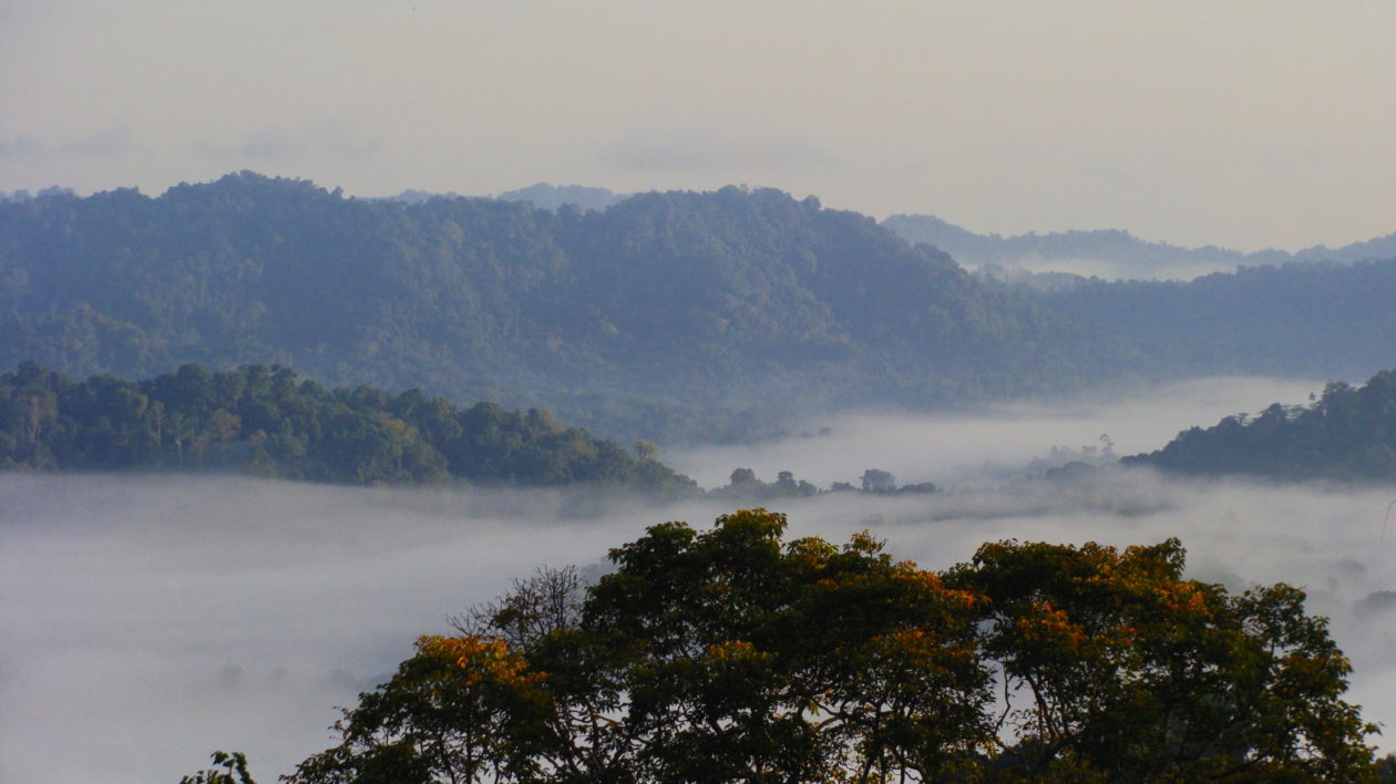
Many of these places are exceedingly remote by conventional standards: only accessible by boat or a rugged 4-wheel drive. But perhaps no place where the Conservancy works is as difficult to access as the remote communities in Papua New Guinea’s Adelbert Mountains.
I know because I walked there.
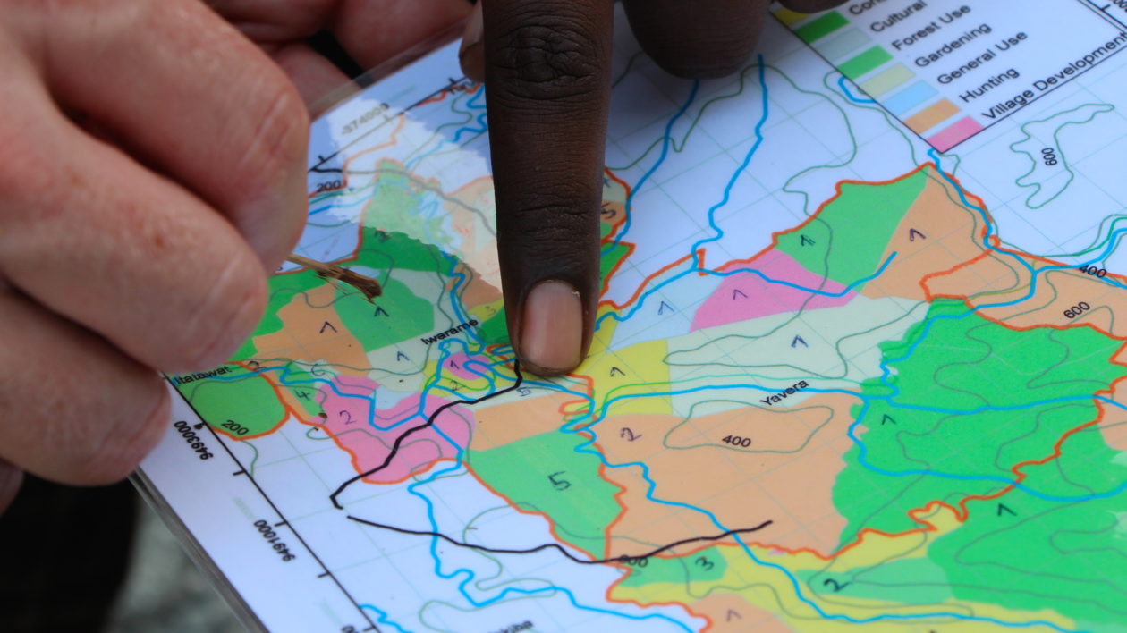
The Conservancy has helped 11 communities here create conservation land-use plans. Ten weeks ago I joined lead scientist Eddie Game, conservation geographer Timothy Boucher, and Princeton University tropical forest ecologist Zuzana Burivalova on an expedition to collect acoustic sampling data here, to inform the size of these conservation areas for key conservation species, like cassowary and birds-of-paradise.
Three Flights, Two PMVs, and One Broken Bridge
The journey is as long as it is difficult.
From Brisbane, Australia, we fly to Port Moresby and then catch the once-daily flight to Madang, which is precisely scheduled around the roosting patterns of the local giant fruit bats. (Trust me, you don’t want one of those things flying into your engine.)
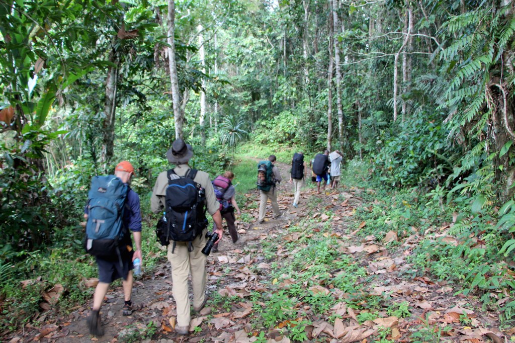
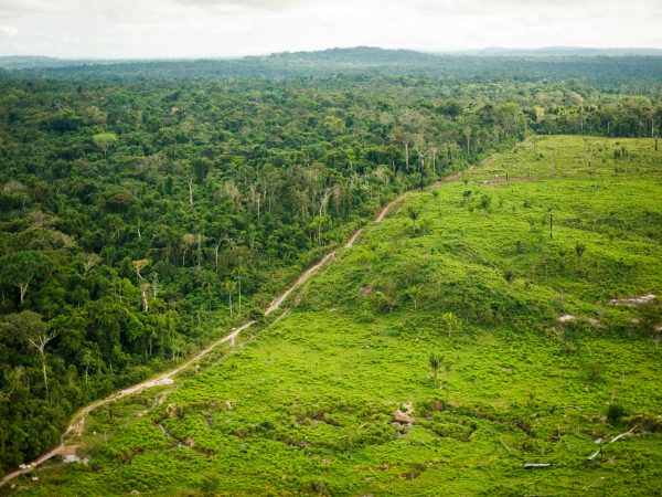
After a night’s rest, we load our gear into a PMV and drive up the North Coast Road, speeding along at more than 100 kilometers per hour despite the fact that the road is more potholes than pavement. Compared to where we’re headed, it’s a smooth ride.
The blurred view out the windows is both repetitive and interesting: intermittent clusters of thatch-roofed huts punctuate long stretches of dense vegetation. People gather along the roadside, walking to destinations unknown or often just sitting in groups at the pavement’s rough edge. Warning honks from our horn send them into the head-high grass bordering the road, children waving and adults staring.
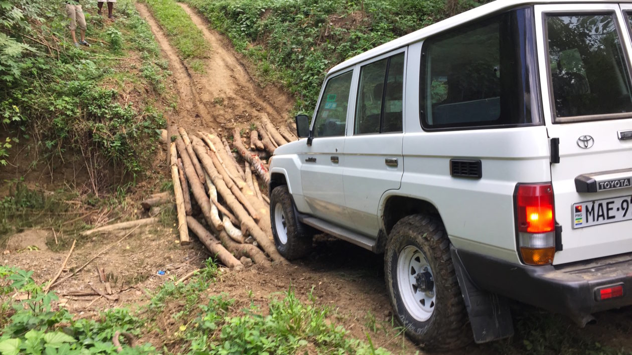
After more than three hours, the PMV turns left onto an unmarked dirt track into the mountains. Before long we reach a bridge spanning a dry stream channel. Logs snap under the weight of the first gear-laden vehicle (a minor inconvenience), but the second vehicle still makes it across. Carefully.
Brush slaps against the doors and windows as we drive on — the rutted road hasn’t slowed our driver down at all — and butterflies meander through the grasses ahead. Any glimpses of our destination are obscured by the twists and turns of the road.
About 30 minutes later the road disintegrates, still beyond the borders of our map. We clamber out and strap on our packs; the real work is about to begin.
Three Hours Down, Nine to Go
The only way to know a place — to really understand it — is to walk through it.
Laden with gear and unused to the conditions, it will take us more than a full day of trekking from the road’s end to reach our destination deep in the forest. Those first kilometers are a mere taste of what lies ahead — 12 hard hours through terrain that resembles the jungle version of an M.C. Escher drawing.
The trail winds steadily through the trees: around massive strangler figs, down ravines, across streams, over fallen logs, and back up ridges. We follow our local guides, never sure where our destination is or when we’ll reach it.
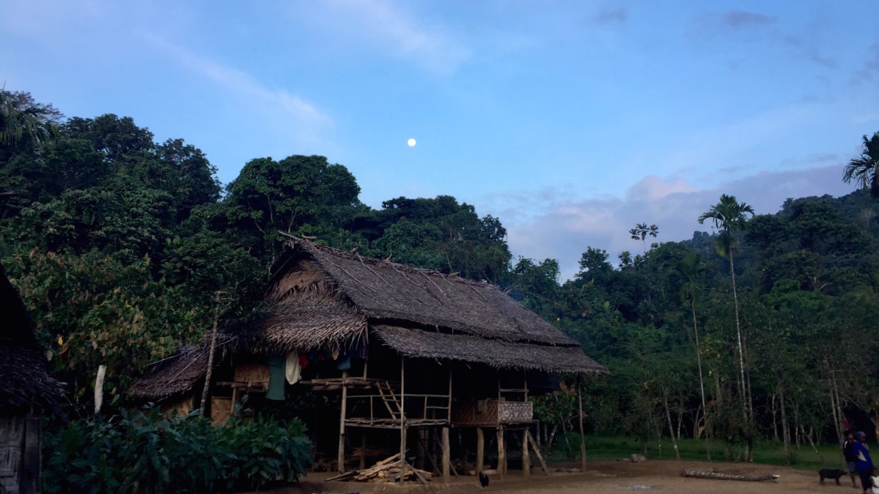
Three hours later we reach the village of Turupav, a full moon already shining brightly overhead as dusk falls.
We lay out our sleeping gear on a raised wooden platform, pigs and chickens snuffling in the dirt underneath us, sniffing my shoes. Massive dragonflies swarm in the deepening darkness, and we can see Jupiter glimmering above us in the indigo sky.
We’re back on the trail early the next morning. By this point, trail seems a misnomer. Vertical, leaf-covered mudslide through the forest is more accurate. At times the path is so steep that I’m hauling myself up with my hands, grabbing any sturdy-looking branch, vine, root, or trunk within reach. Every step is a carefully calculated, high-stakes experiment in friction and gravity. Occasionally the mountains’ damp bedrock is visible between patches of mud; small pebbles crumble away at the slightest touch.
We’re all sweating, individual drops merging to form rivulets that stream down our faces, neck, and arms as humidity radiates towards us from the undergrowth like a sauna.
The air is dead still, but the forest is anything but silent. Untold multitudes of insects drone in the background as Sulphur-crested Cockatoos and Grey Crows shriek out warnings. Every so often a flight of Blyth’s Hornbills erupts from the canopy overhead; their wings sound like a small jet engine roaring across the treetops.
We walk single file, keeping a close eye ahead on our lead guide. One twist in the path and he completely disappears into the undergrowth, as if sucked into the forest by magic. Even my companions disappear after just a few meters — Game’s bobbing orange hat, Boucher’s towering height, and Zuzana’s bright blue shirt are no match for the immense density of the forest.
The effect is both amazing and unsettling. We could be walking in circles and we’d never know it.
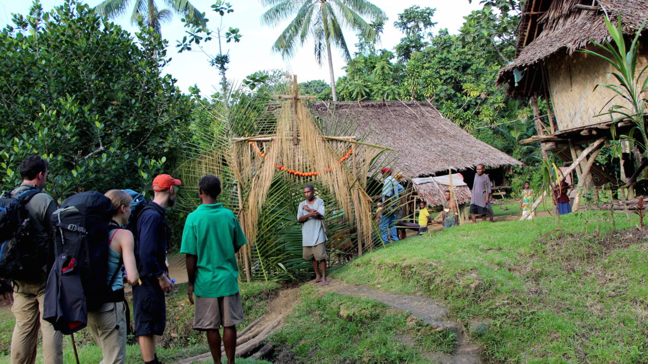
After an indeterminate number of hours, we cut off the path and head up the side of a ridge through a cocoa grove. Not far ahead is the hilltop village of Cacora, in the Iwarame community.
We shake hands with everyone as we arrive and gulp down a whole coconut each — the first of many we’ll have over the next two weeks — as we take in the view. From our vantage point on the ridge we have a rare 360-degree view of the rainforest-blanketed mountains. Dense, impenetrable, and mysterious.
The Final Approach
Now more than 8 hours into the hike, our bodies are exhausted from the making multitude of small corrections necessary to stay upright on the shifting, sliding, wet ground. Tendons and ligaments I forgot existed strain with each step, twist, and stride.
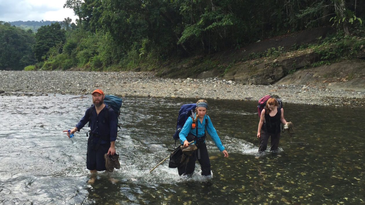
Then suddenly the trail spills out into a wide, sunlit riverbed paved with weathered and water-rounded black and white stones.
Our barefoot guides plow straight into the water and we strip down to our bare feet to follow them, naively attempting to keep our shoes dry. It quickly becomes apparently that we’ll be zigzagging across the river repeatedly, and that dry feet are a thing of the past.
Lesser Birds-of-Paradise call overhead as we press on, catching the occasional glimpse of yellow, russet, and white feathers high in the canopy.
After the final river crossing we stop and rest as someone sends word ahead that we’ve arrived. Snacking on bananas, we’re told the village is not far ahead. After a few minutes we’re told to continue, and we hike on. Just as we begin to suspect that the bananas were a ruse, the forest gives way to a grassy clearing dotted with huts and squealing pigs.
Seven villages past the end of the road, we’ve arrived at our destination — Musiamunat. Game estimates that only a handful of Conservancy staff have ever made this trek. I believe him.
And what happened next was even more spectacular than the effort it took to get here.

After encountering an 11 minute soundbite of the animals there singing at 110 bpm, I just had to jam along.
https://soundcloud.com/kevin-crosby-4/brainforest